MyTopo
Manastash Lake Washington US Topo Map
Couldn't load pickup availability
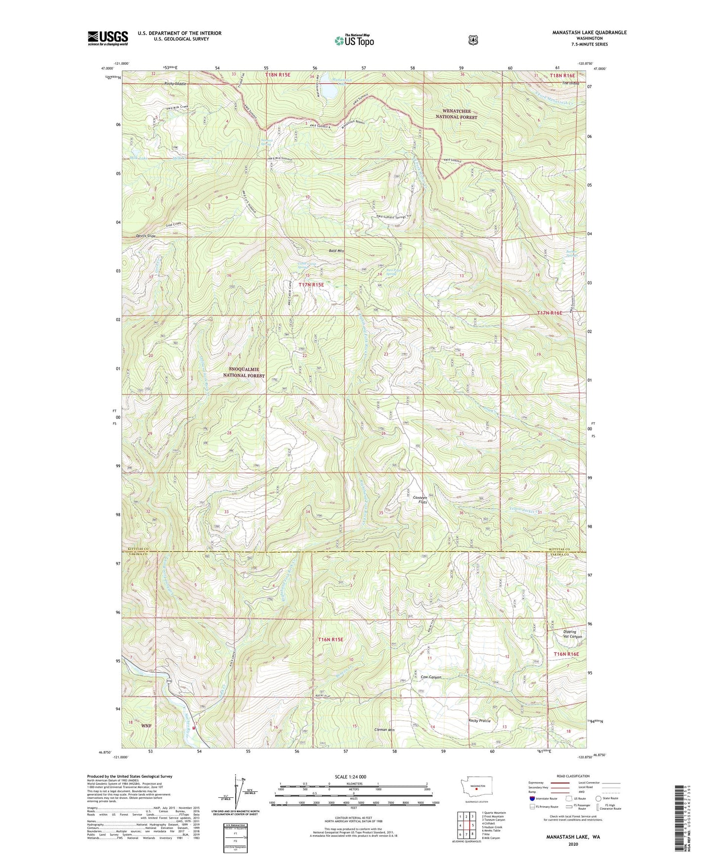
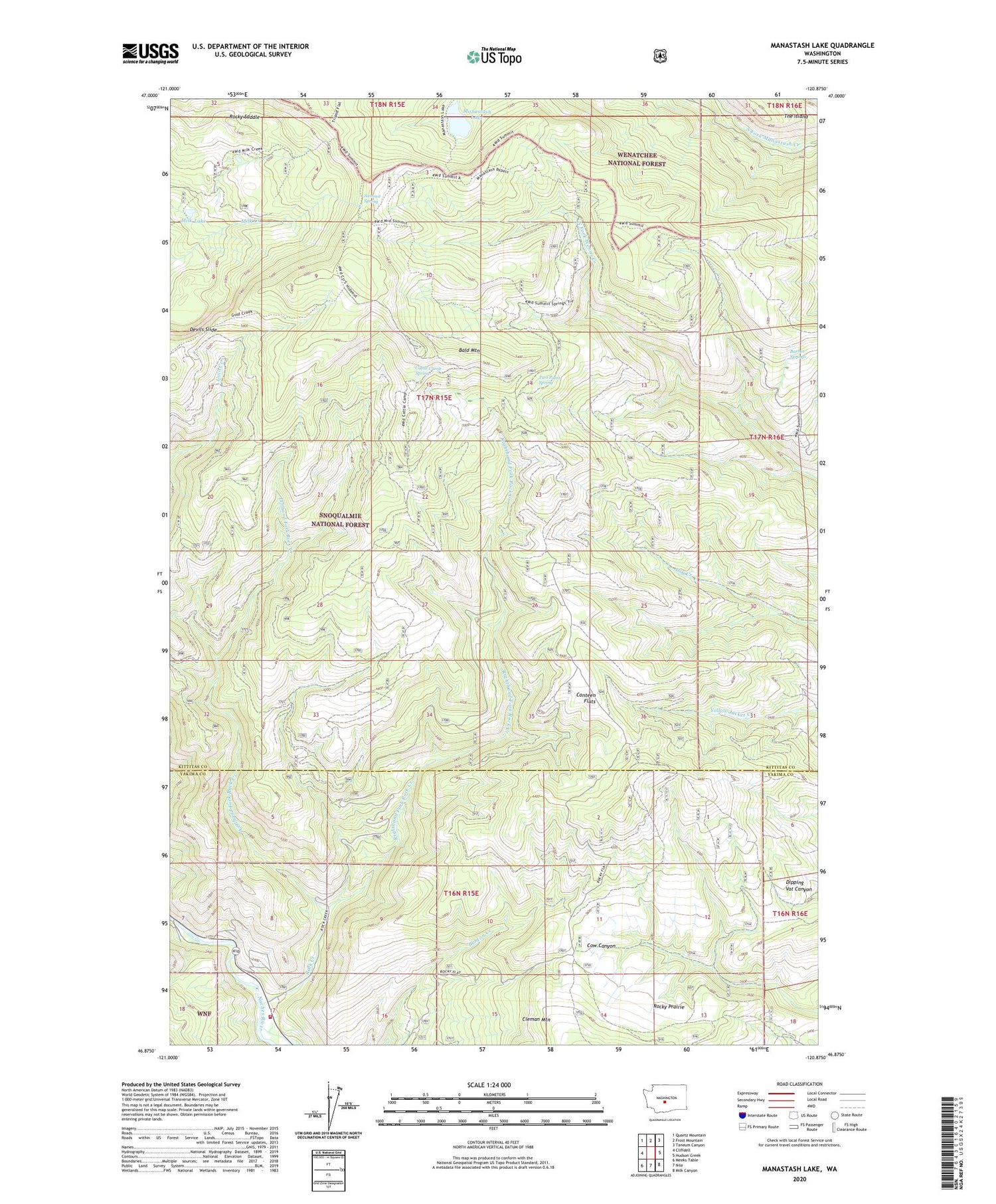
2020 topographic map quadrangle Manastash Lake in the state of Washington. Scale: 1:24000. Based on the newly updated USGS 7.5' US Topo map series, this map is in the following counties: Kittitas, Yakima. The map contains contour data, water features, and other items you are used to seeing on USGS maps, but also has updated roads and other features. This is the next generation of topographic maps. Printed on high-quality waterproof paper with UV fade-resistant inks.
Quads adjacent to this one:
West: Cliffdell
Northwest: Quartz Mountain
North: Frost Mountain
Northeast: Taneum Canyon
East: Hudson Creek
Southeast: Milk Canyon
South: Nile
Southwest: Meeks Table
Contains the following named places: Bald Mountain, Barber Springs, Canteen Flats, Cattle Camp Spring, Devils Slide, Gold Creek Trail, Lefthand Fork Rock Creek, Manastash Lake, Milk Lake, Nile - Cliffdell Fire Department, Righthand Fork Rock Creek, Rock Creek, Rocky Prairie, Rocky Saddle, Summit Spring, Summit Trail, The Island, Two Point Spring