MyTopo
Frost Mountain Washington US Topo Map
Couldn't load pickup availability
Also explore the Frost Mountain Forest Service Topo of this same quad for updated USFS data
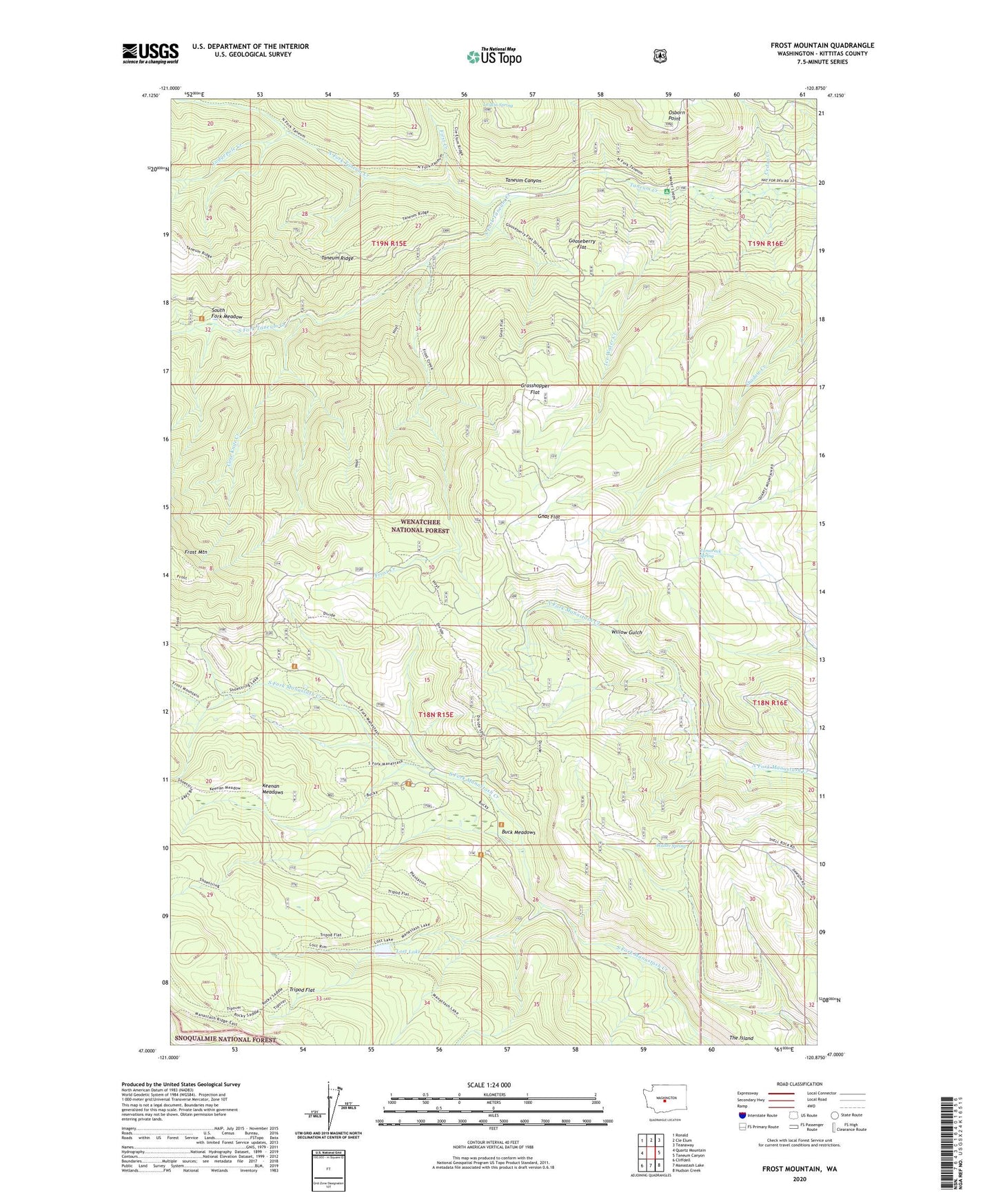
2023 topographic map quadrangle Frost Mountain in the state of Washington. Scale: 1:24000. Based on the newly updated USGS 7.5' US Topo map series, this map is in the following counties: Kittitas. The map contains contour data, water features, and other items you are used to seeing on USGS maps, but also has updated roads and other features. This is the next generation of topographic maps. Printed on high-quality waterproof paper with UV fade-resistant inks.
Quads adjacent to this one:
West: Quartz Mountain
Northwest: Ronald
North: Cle Elum
Northeast: Teanaway
East: Taneum Canyon
Southeast: Hudson Creek
South: Manastash Lake
Southwest: Cliffdell
This map covers the same area as the classic USGS quad with code o47120a8.
Contains the following named places: Buck Meadows, Case Knife Creek, Cedar Creek, First Creek, Frost Creek, Frost Mountain, Gnat Flat, Gnat Flat Trail, Gooseberry Flat, Grasshopper Flat, Ice Water Creek, Keenan Meadows, Keenan Meadows Trail, Lodgepole Creek, Lost Lake, Manastash Cow Camp, Manastash Lake Trail, Manastash Ridge Division, North Fork Taneum Creek, North Fork Trail, Osborn Point, South Fork Meadow, South Fork Meadow Trailhead, South Fork Taneum Creek, Tamarack Spring, Tamarack Spring Campground, Tripod Flat, Walter Spring, Willow Gulch