
MyTopo
Martin Peak Washington US Topo Map
Couldn't load pickup availability
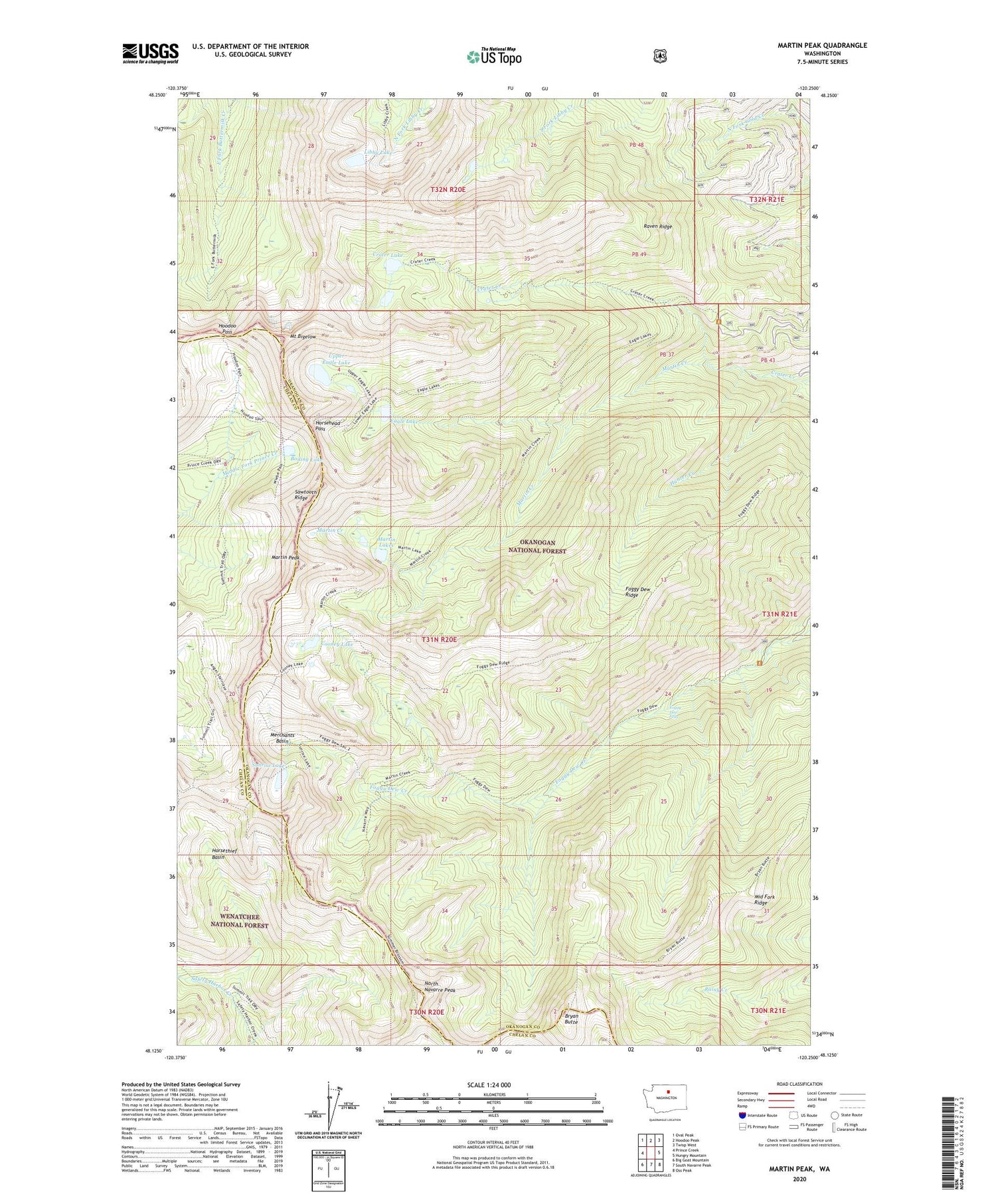
2020 topographic map quadrangle Martin Peak in the state of Washington. Scale: 1:24000. Based on the newly updated USGS 7.5' US Topo map series, this map is in the following counties: Okanogan, Chelan. The map contains contour data, water features, and other items you are used to seeing on USGS maps, but also has updated roads and other features. This is the next generation of topographic maps. Printed on high-quality waterproof paper with UV fade-resistant inks.
Quads adjacent to this one:
West: Prince Creek
Northwest: Oval Peak
North: Hoodoo Peak
Northeast: Twisp West
East: Hungry Mountain
Southeast: Oss Peak
South: South Navarre Peak
Southwest: Big Goat Mountain
Contains the following named places: Boiling Lake, Boiling Lake Recreation Site, Bryan Butte, Cooney Lake, Crater Creek Trailhead, Crater Lake, Eagle Lake, Foggy Dew Falls, Foggy Dew Ridge, Foggy Dew Trailhead, Hoodoo Pass, Horsehead Pass, Horsethief Basin, Hunter Creek, Libby Lake, Libby Lake Dam, Martin Creek, Martin Lakes, Martin Peak, Merchants Basin, Middle Fork Ridge, Mount Bigelow, North Navarre Peak, Raven Ridge, Sunrise Lake, Upper Eagle Lake


