
MyTopo
Mazama Washington US Topo Map
Couldn't load pickup availability
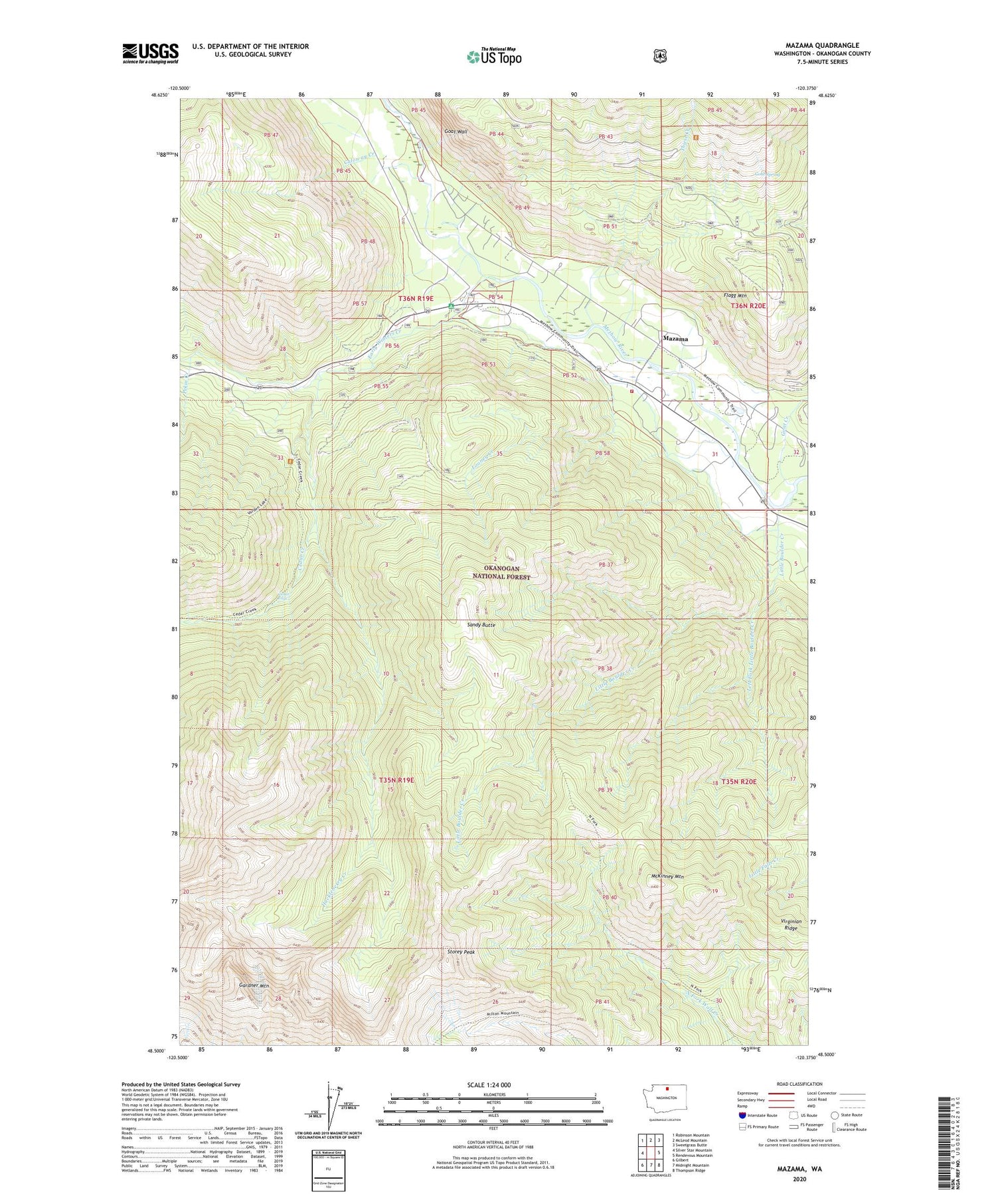
2020 topographic map quadrangle Mazama in the state of Washington. Scale: 1:24000. Based on the newly updated USGS 7.5' US Topo map series, this map is in the following counties: Okanogan. The map contains contour data, water features, and other items you are used to seeing on USGS maps, but also has updated roads and other features. This is the next generation of topographic maps. Printed on high-quality waterproof paper with UV fade-resistant inks.
Quads adjacent to this one:
West: Silver Star Mountain
Northwest: Robinson Mountain
North: McLeod Mountain
Northeast: Sweetgrass Butte
East: Rendevous Mountain
Southeast: Thompson Ridge
South: Midnight Mountain
Southwest: Gilbert
Contains the following named places: Aero Methow Rescue Service, Caloway Creek, Cedar Creek, Cedar Creek Trail, Cedar Falls, Early Winters Campground, Early Winters Creek, Early Winters Visitor Center, Early Winters Visitors Station, Flagg Mountain, Gardner Mountain, Goat Creek, Goat Peak Trail, Goat Spring, Goat Wall, Goat Wall Creek, Huckleberry Creek, Left Fork Little Boulder Creek, Little Boulder Creek, Looney Creek, Mazama, McKinney Mountain, Okanogan Fire District 6 Mazama Fire Department, Pekin Creek, Sandy Butte, Spokane Gulch, Storey Peak, Thiese Creek, Virginian Ridge


