MyTopo
McCoy Lake Washington US Topo Map
Couldn't load pickup availability
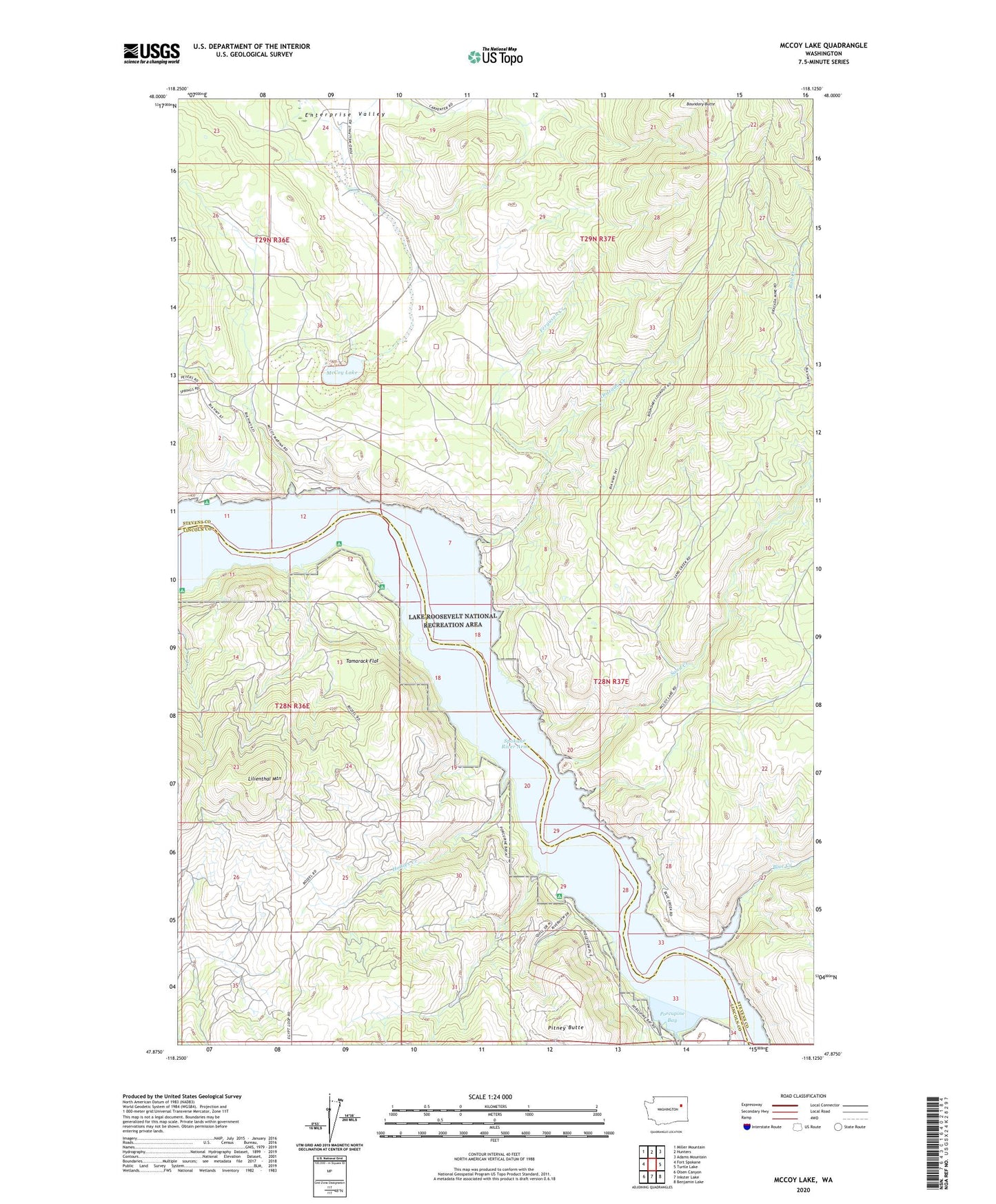
2020 topographic map quadrangle McCoy Lake in the state of Washington. Scale: 1:24000. Based on the newly updated USGS 7.5' US Topo map series, this map is in the following counties: Stevens, Lincoln. The map contains contour data, water features, and other items you are used to seeing on USGS maps, but also has updated roads and other features. This is the next generation of topographic maps. Printed on high-quality waterproof paper with UV fade-resistant inks.
Quads adjacent to this one:
West: Fort Spokane
Northwest: Miller Mountain
North: Hunters
Northeast: Adams Mountain
East: Turtle Lake
Southeast: Benjamin Lake
South: Inkster Lake
Southwest: Olsen Canyon
Contains the following named places: Blue Creek, Boundary Butte, Church of Our Lady of Lourdes, Detillion Campground, Enterprise Valley, Ferguson Creek, Fouress Mine, Hollies Creek, Lilienthal Mountain, McCoy Lake, Orazada Creek, Orazada Mine, Pitney Butte, Pitney Creek, Porcupine Bay, Porcupine Bay Campground, Saint Augustine School, Sand Creek, Spokane Molybdenum Mine, Spokane River Arm, Spokane Tribal Ambulance, Tamarack Flat, West End Church