MyTopo
Mead Washington US Topo Map
Couldn't load pickup availability
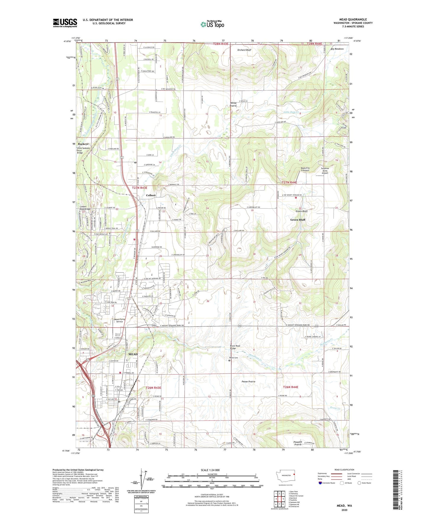
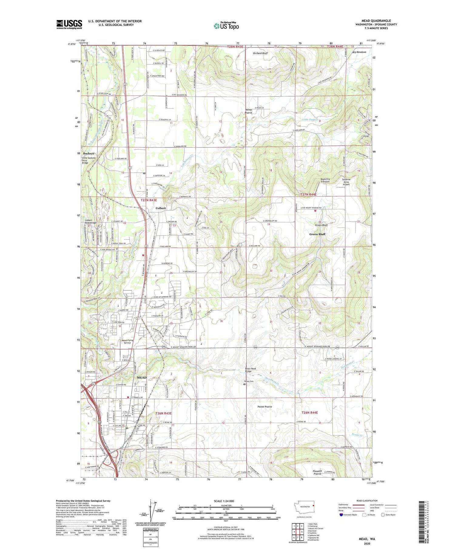
2020 topographic map quadrangle Mead in the state of Washington. Scale: 1:24000. Based on the newly updated USGS 7.5' US Topo map series, this map is in the following counties: Spokane. The map contains contour data, water features, and other items you are used to seeing on USGS maps, but also has updated roads and other features. This is the next generation of topographic maps. Printed on high-quality waterproof paper with UV fade-resistant inks.
Quads adjacent to this one:
West: Dartford
Northwest: Deer Park
North: Chattaroy
Northeast: Mount Kit Carson
East: Foothills
Southeast: Greenacres
South: Spokane NE
Southwest: Spokane NW
Contains the following named places: Big Meadows, Boyle R & D Airport, Bruce Road Bridge, Buckeye, Circle Bar J Boys Ranch, Colbert, Colbert Elementary School, Colbert Post Office, Colbert Road Bridge, Dean, Faith Christian School, Green Bluff, Green Bluff Census Designated Place, Indian Treaty Tree, Little Spokane Drive Bridge, Mater Cleri Seminary, Mead, Mead Census Designated Place, Mead Flying Service, Mead Junior High School, Mead Post Office, North Fork Little Deep Creek, Pell Creek, Peone Cemetery, Peone Creek, Peone Creek Park, Peone Prairie, South Fork Little Deep Creek, Spokane County Fire District 4 Station 44 Colbert, Spokane County Fire District 4 Station 47 Greenbluff, Spokane County Fire District 9 Station 92, Sunshine Acres Airport, Valley Prairie, Wayside, ZIP Code: 99005