MyTopo
Mount Blum Washington US Topo Map
Couldn't load pickup availability
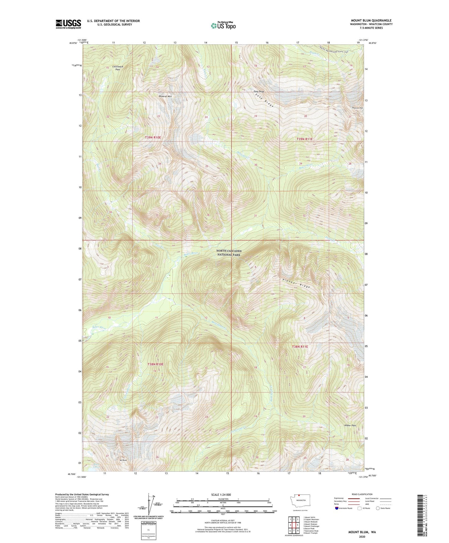
2020 topographic map quadrangle Mount Blum in the state of Washington. Scale: 1:24000. Based on the newly updated USGS 7.5' US Topo map series, this map is in the following counties: Whatcom. The map contains contour data, water features, and other items you are used to seeing on USGS maps, but also has updated roads and other features. This is the next generation of topographic maps. Printed on high-quality waterproof paper with UV fade-resistant inks.
Quads adjacent to this one:
West: Mount Shuksan
Northwest: Mount Sefrit
North: Copper Mountain
Northeast: Mount Redoubt
East: Mount Challenger
Southeast: Mount Triumph
South: Damnation Peak
Southwest: Bacon Peak
Contains the following named places: Bald Eagle Creek, Blum Lakes, Chilliwack Pass, East Whatcom Division, Easy Peak, Easy Ridge, Jasper Pass, Lonesome Creek, Mineral Creek, Mineral Mountain, Mount Blum, Pass Creek, Picket Creek, Pioneer Ridge, Scramble Creek, Tapto Camp, Tapto Creek