
MyTopo
Mount Leona Washington US Topo Map
Couldn't load pickup availability
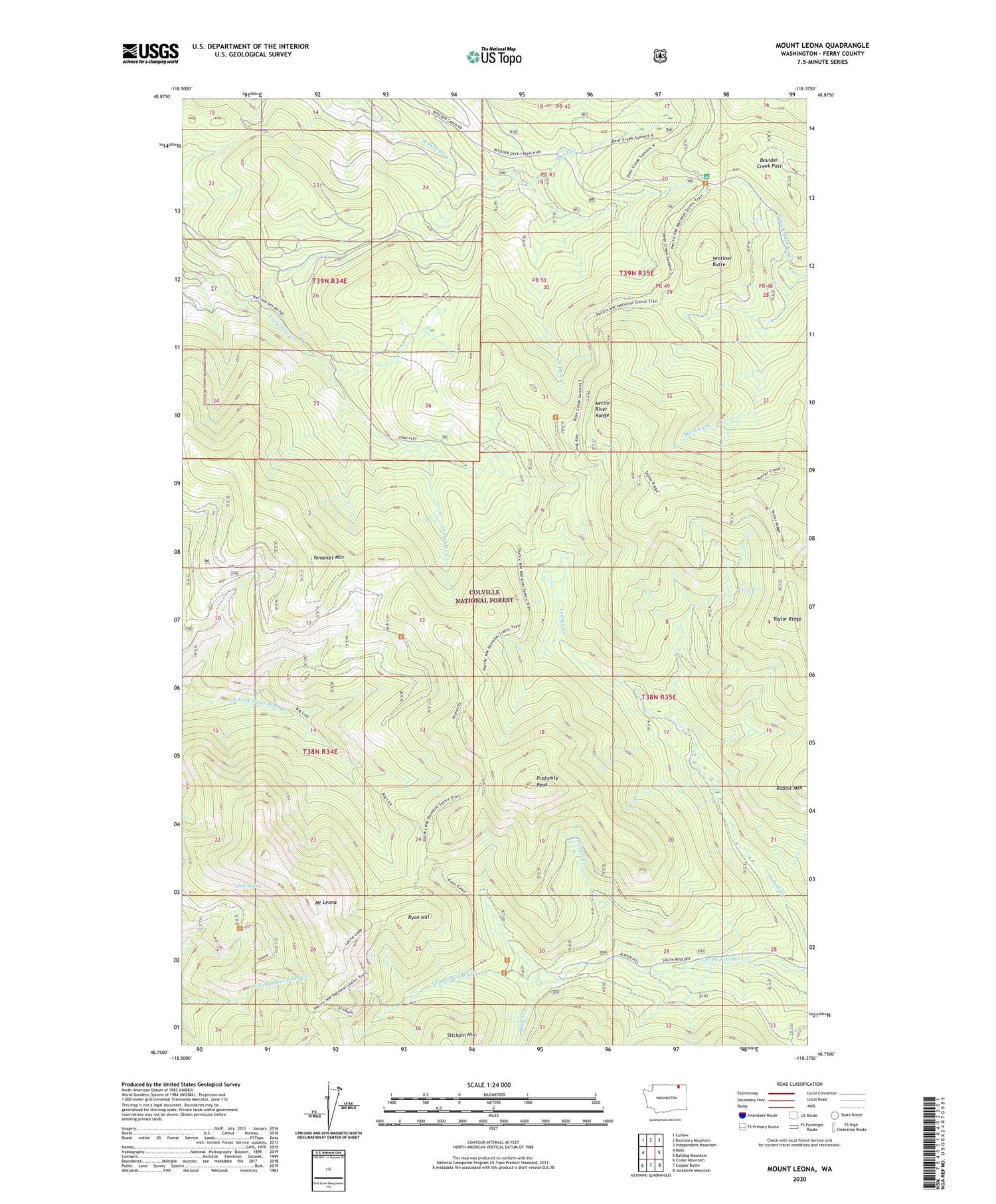
2020 topographic map quadrangle Mount Leona in the state of Washington. Scale: 1:24000. Based on the newly updated USGS 7.5' US Topo map series, this map is in the following counties: Ferry. The map contains contour data, water features, and other items you are used to seeing on USGS maps, but also has updated roads and other features. This is the next generation of topographic maps. Printed on high-quality waterproof paper with UV fade-resistant inks.
Quads adjacent to this one:
West: Malo
Northwest: Curlew
North: Boundary Mountain
Northeast: Independent Mountain
East: Bulldog Mountain
Southeast: Jackknife Mountain
South: Copper Butte
Southwest: Cooke Mountain
Contains the following named places: Boulder Creek Pass, Deer Creek Summit Campground, Kettle River Range, Mick Creek, Midget Creek, Mount Leona, Profanity Peak, Rabbit Mountain, Ryan Cabin, Ryan Hill, Sentinel Butte, Slide Spring, Summit Guard Station, Taylor Ridge, Third Creek, Tonasket Mountain


