MyTopo
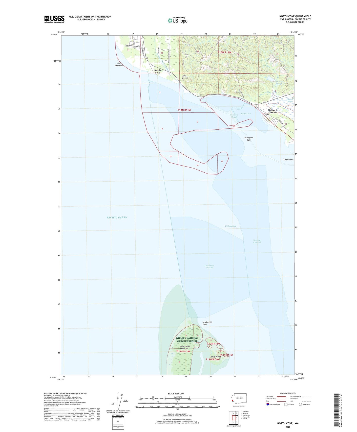
North Cove Washington US Topo Map
Couldn't load pickup availability
2023 topographic map quadrangle North Cove in the state of Washington. Scale: 1:24000. Based on the newly updated USGS 7.5' US Topo map series, this map is in the following counties: Pacific. The map contains contour data, water features, and other items you are used to seeing on USGS maps, but also has updated roads and other features. This is the next generation of topographic maps. Printed on high-quality waterproof paper with UV fade-resistant inks.
Quads adjacent to this one:
North: Grayland
Northeast: Western
East: Bay Center
Southeast: Nemah
South: Oysterville
This map covers the same area as the classic USGS quad with code o46124f1.
Contains the following named places: Cannery Slough, Cape Shoalwater, Dexter by the Sea, Empire Spit, Grassy Island, Graveyard Spit, Kindred Slough, Leadbetter Channel, Leadbetter Point, Nahcotta Channel, North Cove, Shoalwater Bay Indian Reservation, Teal Duck Slough, Teal Duck Slough Dam, Tokeland Post Office, Willapa Bay, Willapa Bay Lighthouse