MyTopo
Bay Center Washington US Topo Map
Couldn't load pickup availability
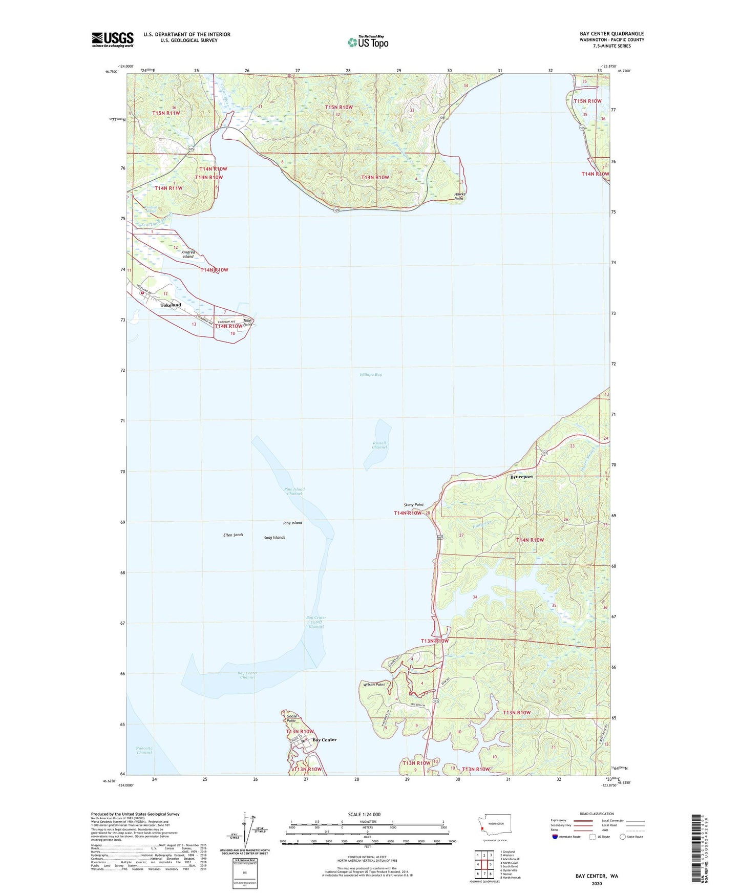
2023 topographic map quadrangle Bay Center in the state of Washington. Scale: 1:24000. Based on the newly updated USGS 7.5' US Topo map series, this map is in the following counties: Pacific. The map contains contour data, water features, and other items you are used to seeing on USGS maps, but also has updated roads and other features. This is the next generation of topographic maps. Printed on high-quality waterproof paper with UV fade-resistant inks.
Quads adjacent to this one:
West: North Cove
Northwest: Grayland
North: Western
Northeast: Aberdeen SE
East: South Bend
Southeast: North Nemah
South: Nemah
Southwest: Oysterville
This map covers the same area as the classic USGS quad with code o46123f8.
Contains the following named places: Bay Center, Bay Center Channel, Bay Center Cutoff Channel, Bay Center Post Office, Bayshore Recreational Vehicle Park, Bone River, Bruceport, Bruceport Park, Bush Pioneer County Park, Cedar River, Ellen Sands, Freshwater Creek, Goose Point, Hansen Creek, Hawks Point, Holton Ranch, Kindred Island, Kindred Slough, Niawiakum River, Norris Slough, North River, Pacific County Fire District 5 Station 2, Palix River, Pine Island, Pine Island Channel, Russell Channel, Smith Creek, Snag Islands, Stony Point, Teal Duck Slough, Toke Point, Tokeland, Tokeland Census Designated Place, Tokeland Marina, Venice, Wilson Point, ZIP Code: 98590