MyTopo
Grayland Washington US Topo Map
Couldn't load pickup availability
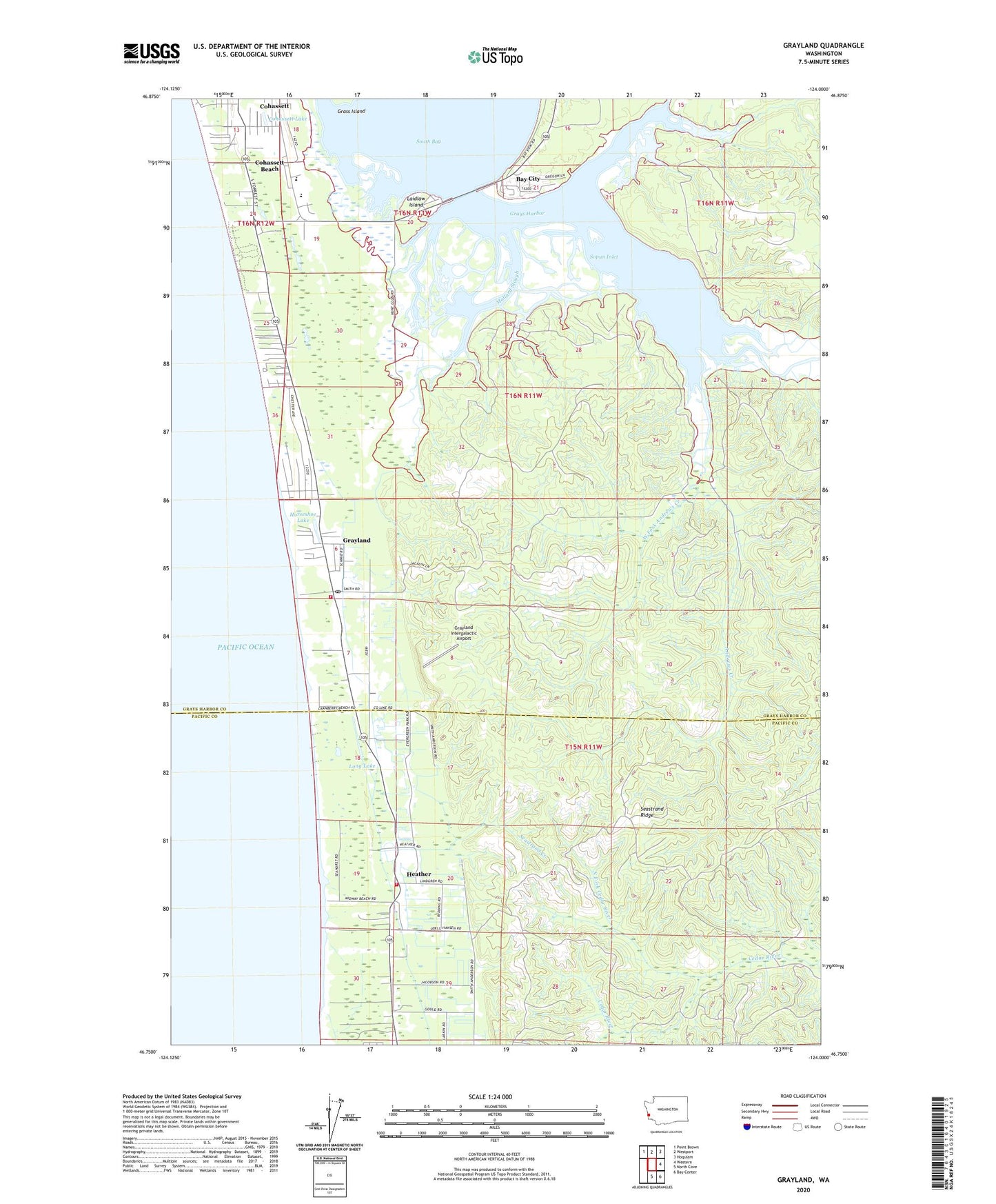
2023 topographic map quadrangle Grayland in the state of Washington. Scale: 1:24000. Based on the newly updated USGS 7.5' US Topo map series, this map is in the following counties: Grays Harbor, Pacific. The map contains contour data, water features, and other items you are used to seeing on USGS maps, but also has updated roads and other features. This is the next generation of topographic maps. Printed on high-quality waterproof paper with UV fade-resistant inks.
Quads adjacent to this one:
Northwest: Point Brown
North: Westport
Northeast: Hoquiam
East: Western
Southeast: Bay Center
South: North Cove
This map covers the same area as the classic USGS quad with code o46124g1.
Contains the following named places: Andrews Creek, Barlow Creek, Bay City, Beardslee Slough, Benn, Coastal Community Church, Cohassett, Cohassett Beach, Cohassett Beach Census Designated Place, Cohassett Lake, Dempsey Creek, Drainage Ditch Number 1, Elk River, Furford Cranberry Museum, Grayland, Grayland Access State Park, Grayland Beach State Park, Grayland Census Designated Place, Grayland Intergalactic Airport, Grayland Post Office, Grays Harbor Fire District 11 Grayland Fire Department, Heather, Horseshoe Lake, Kenanna Recreational Vehicle Park, Laidlaw Island, Laidlow, Long Lake, Lutheran Church of Twin Harbors, Mallard Slough, North Fork Cedar River, Ocosta Elementary School, Ocosta Junior and Senior High School, Ocosta School District 172 Office, Pacific County Fire District 5 North Cove Tokeland Shoalwater Bay Volunteer Fire Station 1, Roberts Farm, Saint Paul's Catholic Church, Seastrand Creek, Seastrand Ridge, Sopun Inlet, South Beach Christian Center, South Beach Christian Daycare Center, South Beach State Park, The Church of Jesus Christ of Latter Day Saints, Twin Harbors Beach State Park, Twin Harbors Beaches, West Fork Andrews Creek, Westport Division, ZIP Code: 98547