MyTopo
Tanwax Lake Washington US Topo Map
Couldn't load pickup availability
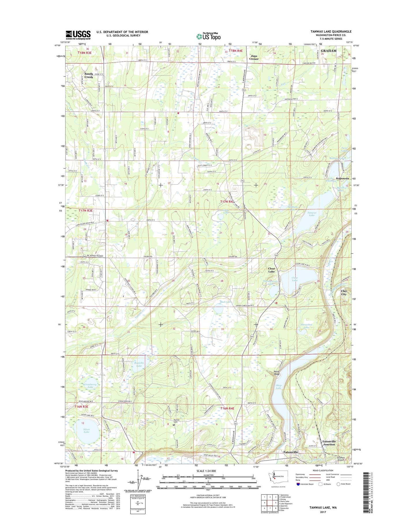
2023 topographic map quadrangle Tanwax Lake in the state of Washington. Scale: 1:24000. Based on the newly updated USGS 7.5' US Topo map series, this map is in the following counties: Pierce. The map contains contour data, water features, and other items you are used to seeing on USGS maps, but also has updated roads and other features. This is the next generation of topographic maps. Printed on high-quality waterproof paper with UV fade-resistant inks.
Quads adjacent to this one:
West: Harts Lake
Northwest: Spanaway
North: Frederickson
Northeast: Orting
East: Lake Kapowsin
Southeast: Elbe
South: Eatonville
Southwest: Bald Hill
This map covers the same area as the classic USGS quad with code o46122h3.
Contains the following named places: Benbow Lakes, Benston Community Church, Byron Lake, Clay City, Clear Lake, Clear Lake Census Designated Place, Cranberry Lake, Eatonville Junction, Horseshoe Lake, Jims Corner, Johnsons Corner, Lake Whitman, Leber, Lynch Creek, Mud Lake, Ohop, Ohop Lake, Pierce County Fire District 21 Graham Fire and Rescue Station 93, Pierce County Sheriff's Office Eatonville, Point Ohop, Rainier Cemetery, Rapjohn Lake, Silver Lake, South Pierce Fire and Rescue Station 170 Headquarters, South Pierce Fire and Rescue Station 175, South Pierce Fire and Rescue Station 176, Stidham Lake, Tanwax Greens Golf Course, Tanwax Lake, Tanwax Lake Dam, Thompson Dam, Three Hundred Fourth Street Landfill, Trout Lake, Twentyfive Mile Creek, Twentyseven Lake, Twin Lakes, Weyerhaeuser Elementary School