MyTopo
Le Dout Creek Washington US Topo Map
Couldn't load pickup availability
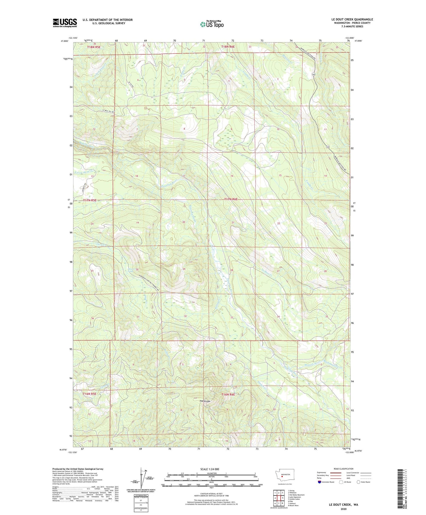
2023 topographic map quadrangle Le Dout Creek in the state of Washington. Scale: 1:24000. Based on the newly updated USGS 7.5' US Topo map series, this map is in the following counties: Pierce. The map contains contour data, water features, and other items you are used to seeing on USGS maps, but also has updated roads and other features. This is the next generation of topographic maps. Printed on high-quality waterproof paper with UV fade-resistant inks.
Quads adjacent to this one:
West: Lake Kapowsin
Northwest: Orting
North: Wilkeson
Northeast: Old Baldy Mountain
East: Golden Lakes
Southeast: Mount Wow
South: Ashford
Southwest: Elbe
This map covers the same area as the classic USGS quad with code o46122h1.
Contains the following named places: Electron Diversion Dam, Electron Flume, Kellog Creek, Le Dout Creek, Mowich River, Niesson Creek, Ohop Creek Ponds, Rushingwater Creek, The Divide