MyTopo
Pyramid Mountain Washington US Topo Map
Couldn't load pickup availability
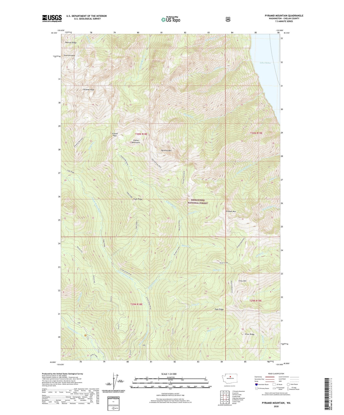
2020 topographic map quadrangle Pyramid Mountain in the state of Washington. Scale: 1:24000. Based on the newly updated USGS 7.5' US Topo map series, this map is in the following counties: Chelan. The map contains contour data, water features, and other items you are used to seeing on USGS maps, but also has updated roads and other features. This is the next generation of topographic maps. Printed on high-quality waterproof paper with UV fade-resistant inks.
Quads adjacent to this one:
West: Saska Peak
Northwest: Pinnacle Mountain
North: Lucerne
Northeast: Prince Creek
East: Big Goat Mountain
Southeast: Brief
South: Silver Falls
Southwest: Chikamin Creek
Contains the following named places: Butte Creek, Cardinal Peak, Corral Creek, Crow Creek, Crow Hill, Duncan Creek, Graham Mountain, Grouse Creek, Grouse Pass, Little Creek, Pope Ridge, Pugh Ridge, Pyramid Creek, Pyramid Mountain, Sheep Creek, Silver Ridge, South Pyramid Creek, Spruce Grove Campground, Three Creek Campground