MyTopo
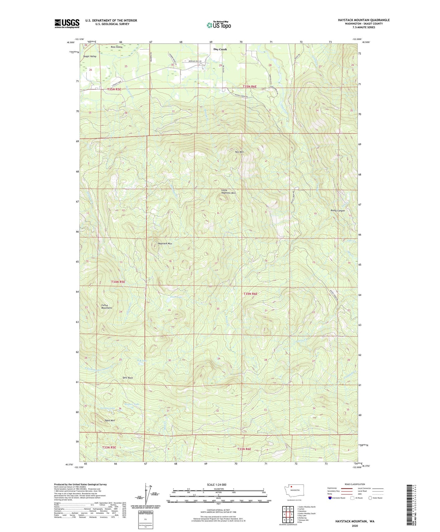
Haystack Mountain Washington US Topo Map
Couldn't load pickup availability
Also explore the Haystack Mountain Forest Service Topo of this same quad for updated USFS data
2023 topographic map quadrangle Haystack Mountain in the state of Washington. Scale: 1:24000. Based on the newly updated USGS 7.5' US Topo map series, this map is in the following counties: Skagit. The map contains contour data, water features, and other items you are used to seeing on USGS maps, but also has updated roads and other features. This is the next generation of topographic maps. Printed on high-quality waterproof paper with UV fade-resistant inks.
Quads adjacent to this one:
West: Sedro-Woolley South
Northwest: Sedro-Woolley North
North: Lyman
Northeast: Hamilton
East: Day Lake
Southeast: Oso
South: Stimson Hill
Southwest: McMurray
This map covers the same area as the classic USGS quad with code o48122d1.
Contains the following named places: Coal Creek, Cultus Mountains, Day Creek, Day Creek Sand and Gravel Quarry, Dixie Lake, Fall Creek, Gordon Lake, Haystack Mountain, Little Haystack Mountain, R B Lake, Rocky Canyon, Rocky Creek, Sorenson Creek, Split Rock, Table Mountain, Talc Mountain, Wagner Lake