MyTopo
Shull Mountain Washington US Topo Map
Couldn't load pickup availability
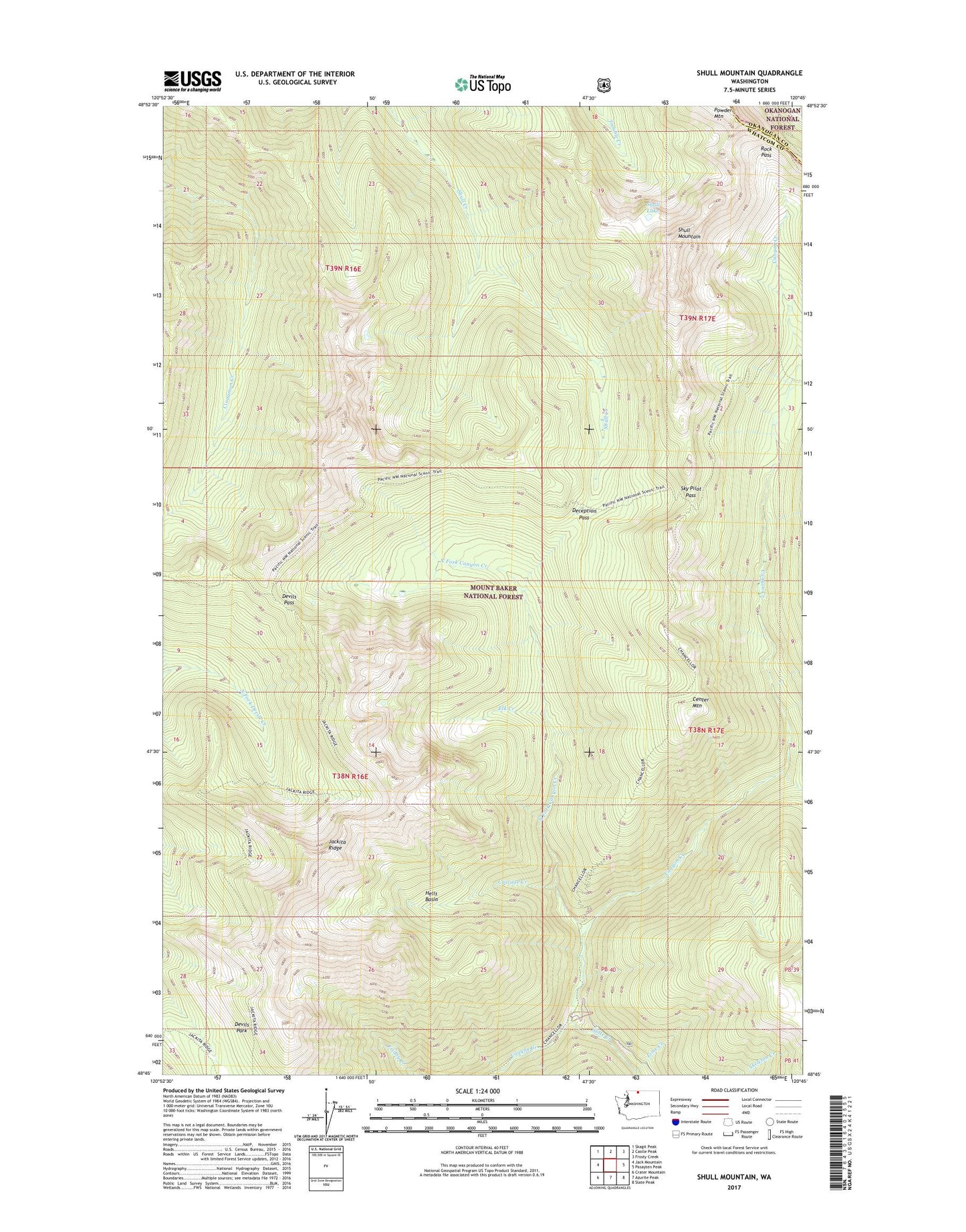
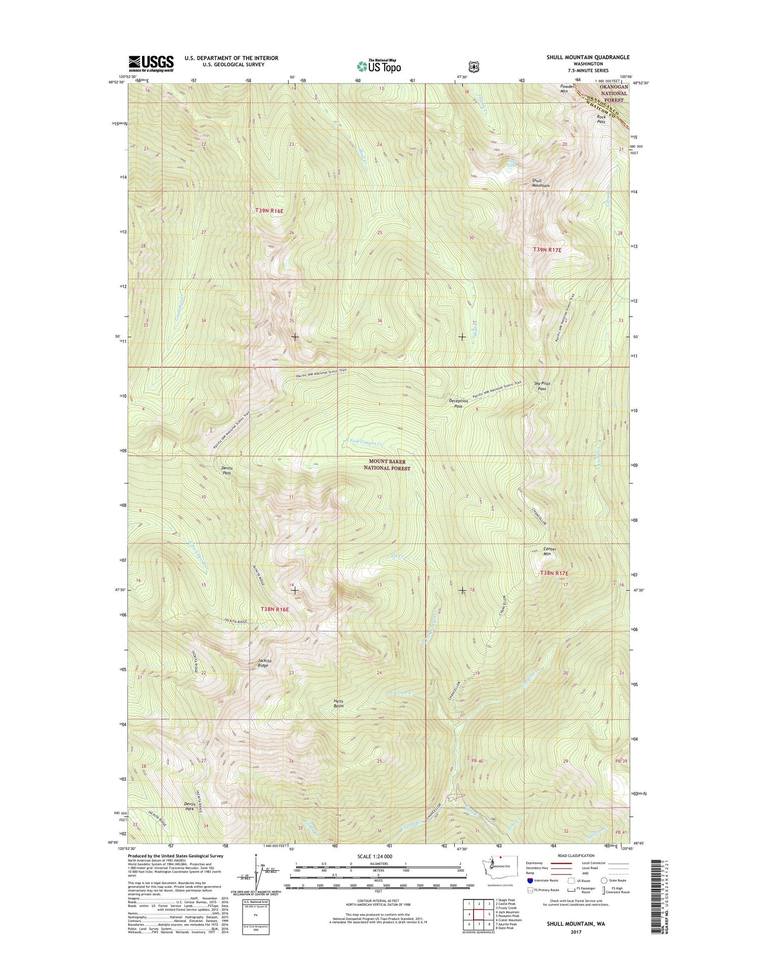
2020 topographic map quadrangle Shull Mountain in the state of Washington. Scale: 1:24000. Based on the newly updated USGS 7.5' US Topo map series, this map is in the following counties: Whatcom, Okanogan. The map contains contour data, water features, and other items you are used to seeing on USGS maps, but also has updated roads and other features. This is the next generation of topographic maps. Printed on high-quality waterproof paper with UV fade-resistant inks.
Quads adjacent to this one:
West: Jack Mountain
Northwest: Skagit Peak
North: Castle Peak
Northeast: Frosty Creek
East: Pasayten Peak
Southeast: Slate Peak
South: Azurite Peak
Southwest: Crater Mountain
Contains the following named places: Anacortes Crossing, Barron Creek, Cascade Creek, Center Mountain, Chancellor Campground, Deception Pass, Devils Park Shelter, Devils Pass, Elk Creek, Hells Basin, Jackita Ridge, Lime Creek, North Fork Canyon Creek, Rock Pass, Shull Lake, Shull Mountain, Sky Pilot Pass, Slate Creek