
MyTopo
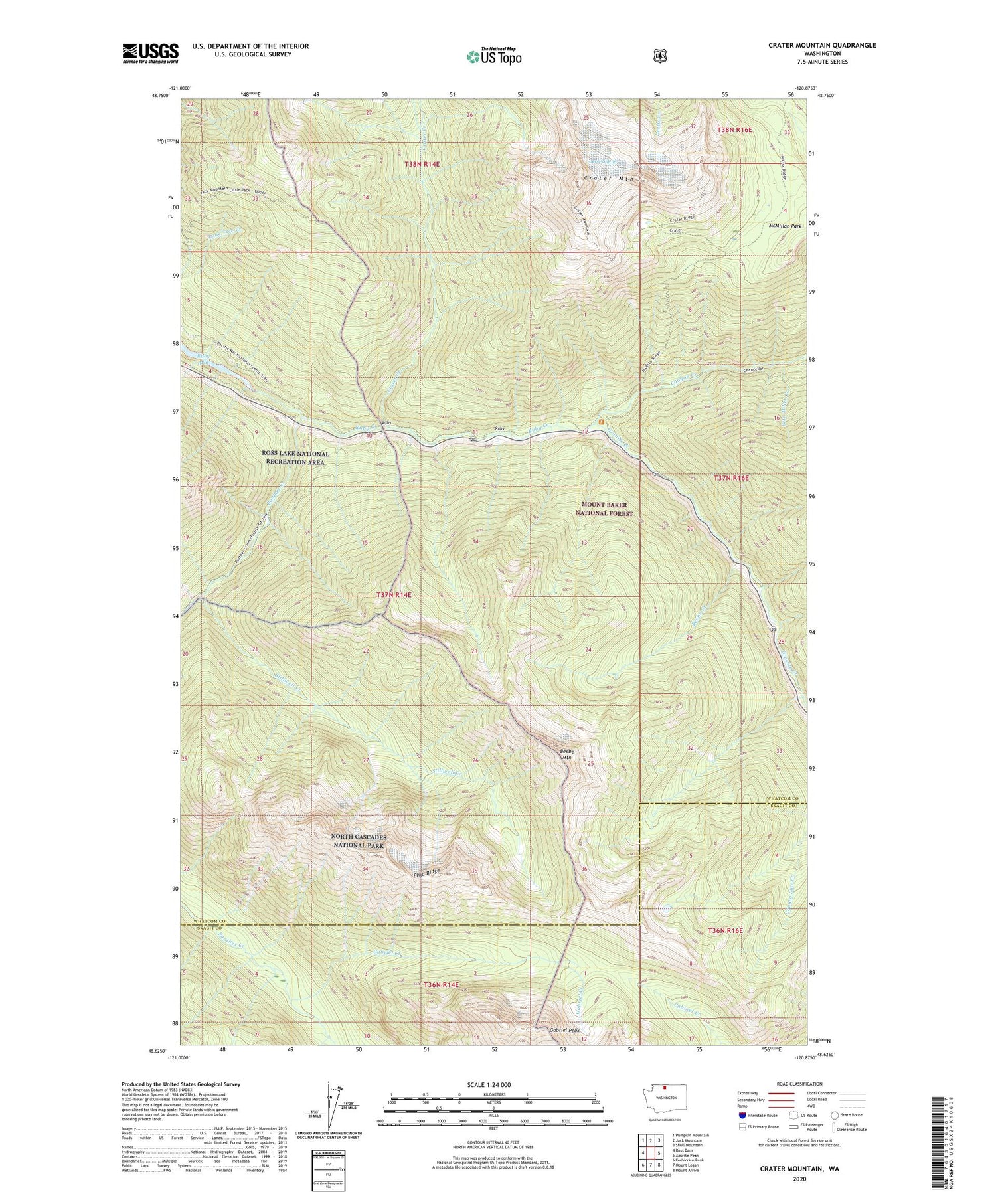
Crater Mountain Washington US Topo Map
Couldn't load pickup availability
Also explore the Crater Mountain Forest Service Topo of this same quad for updated USFS data
2023 topographic map quadrangle Crater Mountain in the state of Washington. Scale: 1:24000. Based on the newly updated USGS 7.5' US Topo map series, this map is in the following counties: Whatcom, Skagit. The map contains contour data, water features, and other items you are used to seeing on USGS maps, but also has updated roads and other features. This is the next generation of topographic maps. Printed on high-quality waterproof paper with UV fade-resistant inks.
Quads adjacent to this one:
West: Ross Dam
Northwest: Pumpkin Mountain
North: Jack Mountain
Northeast: Shull Mountain
East: Azurite Peak
Southeast: Mount Arriva
South: Mount Logan
Southwest: Forbidden Peak
This map covers the same area as the classic USGS quad with code o48120f8.
Contains the following named places: Beebe Creek, Beebe Mountain, Canyon Creek, Canyon Creek Trailhead, Crater Creek, Crater Mountain, Elija Ridge, Gabriel Creek, Gabriel Peak, Granite Creek, Granite Creek Guard Station, Jack Mountain Trail, Jerry Glacier, Lookout Number 2, McMillan Park, Panther Creek, Pete Miller Creek, Rowleys Chasm, Ruby Creek, Stillwell Creek


