MyTopo
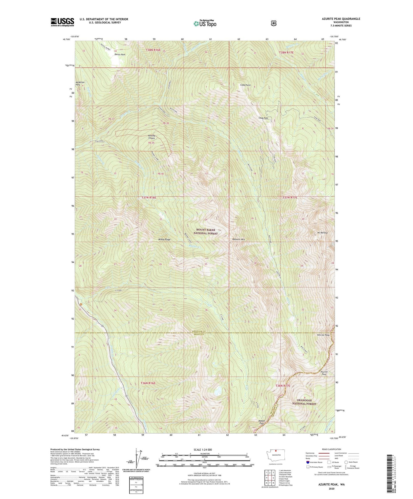
Azurite Peak Washington US Topo Map
Couldn't load pickup availability
Also explore the Azurite Peak Forest Service Topo of this same quad for updated USFS data
2023 topographic map quadrangle Azurite Peak in the state of Washington. Scale: 1:24000. Based on the newly updated USGS 7.5' US Topo map series, this map is in the following counties: Whatcom, Skagit, Okanogan. The map contains contour data, water features, and other items you are used to seeing on USGS maps, but also has updated roads and other features. This is the next generation of topographic maps. Printed on high-quality waterproof paper with UV fade-resistant inks.
Quads adjacent to this one:
West: Crater Mountain
Northwest: Jack Mountain
North: Shull Mountain
Northeast: Pasayten Peak
East: Slate Peak
Southeast: Washington Pass
South: Mount Arriva
Southwest: Mount Logan
This map covers the same area as the classic USGS quad with code o48120f7.
Contains the following named places: Azurite Mine, Azurite Pass, Azurite Peak, Boulder Creek, Cabinet Creek, Cady Pass, Cady Point, Cedar Crossing, County Line Creek, Devils Park, East Creek, East Creek Trailhead, Fourmile Camp, Friday Creek, Gold Hill Mine, Holmes Creek, Majestic Mountain, McKay Ridge, Mebee Pass, Mill Creek, Mill Creek Trail, Mount Ballard, Nickol Creek, North American Mine, Rockefeller Creek, Rowley Chasm, Skeleton Creek, South Fork Slate Creek