MyTopo
Snowking Mountain Washington US Topo Map
Couldn't load pickup availability
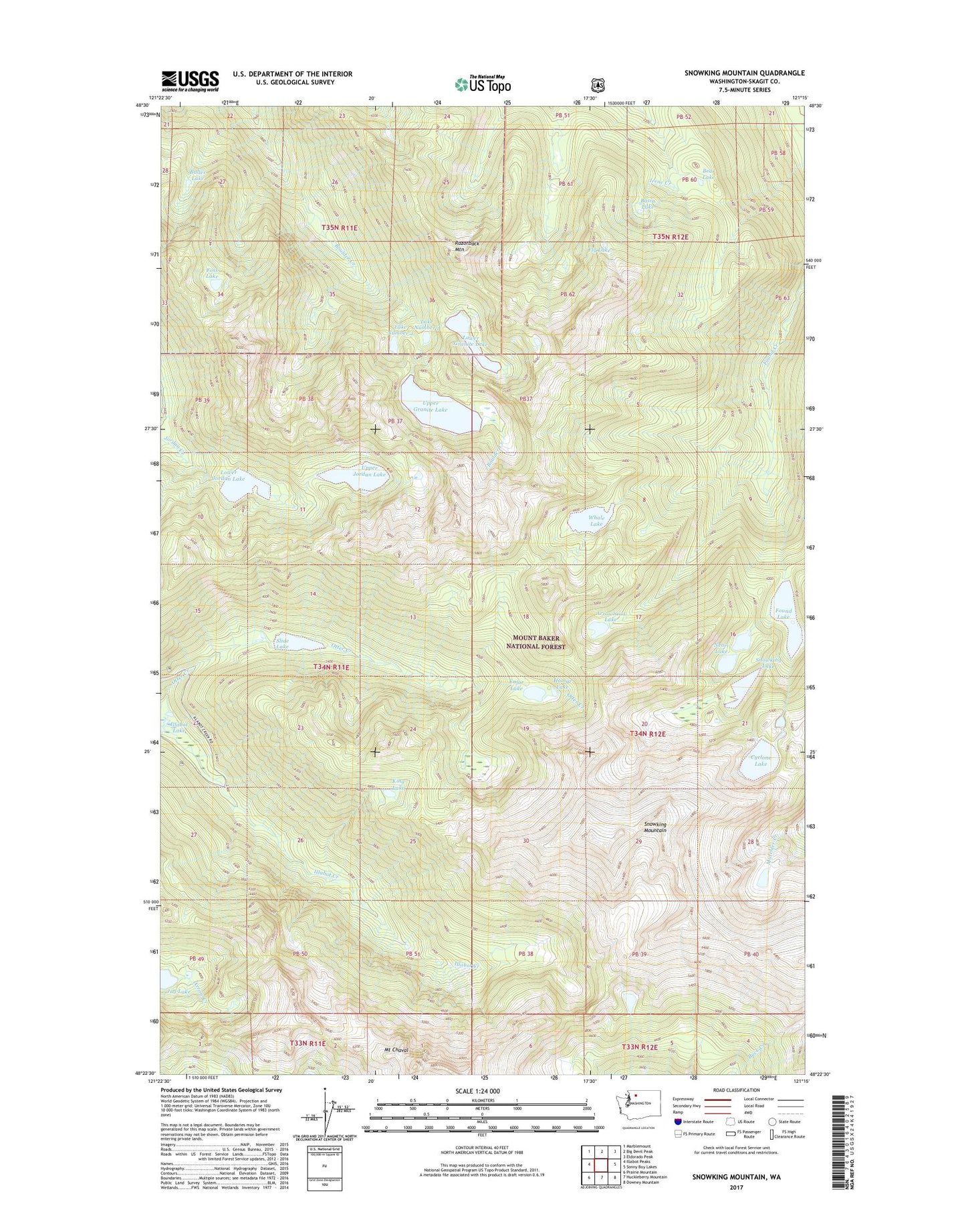
2020 topographic map quadrangle Snowking Mountain in the state of Washington. Scale: 1:24000. Based on the newly updated USGS 7.5' US Topo map series, this map is in the following counties: Skagit. The map contains contour data, water features, and other items you are used to seeing on USGS maps, but also has updated roads and other features. This is the next generation of topographic maps. Printed on high-quality waterproof paper with UV fade-resistant inks.
Quads adjacent to this one:
West: Illabot Peaks
Northwest: Marblemount
North: Big Devil Peak
Northeast: Eldorado Peak
East: Sonny Boy Lakes
Southeast: Downey Mountain
South: Huckleberry Mountain
Southwest: Prairie Mountain
Contains the following named places: Arrowhead Lake, Basin Lake, Bear Lake, Buller Lake, Cyclone Lake, East Skagit Division, Enjar Lake, Fly Lake, Foss Lake, Found Lake, Found Lakes, Granite Lakes, Hamar Lake, Illabot Lake, Jordan Lakes, Jug Lake, King Lake, Lake Number 1, Lake Number 2, Lower Granite Lake, Lower Jordan Lake, Mount Chaval, Neori Lake, Otter Creek, Razorback Mountain, Skaro Lake, Slide Lake, Snowking Lake, Snowking Mountain, Upper Granite Lake, Upper Jordan Lake, Whale Lake, ZIP Code: 98267