
MyTopo
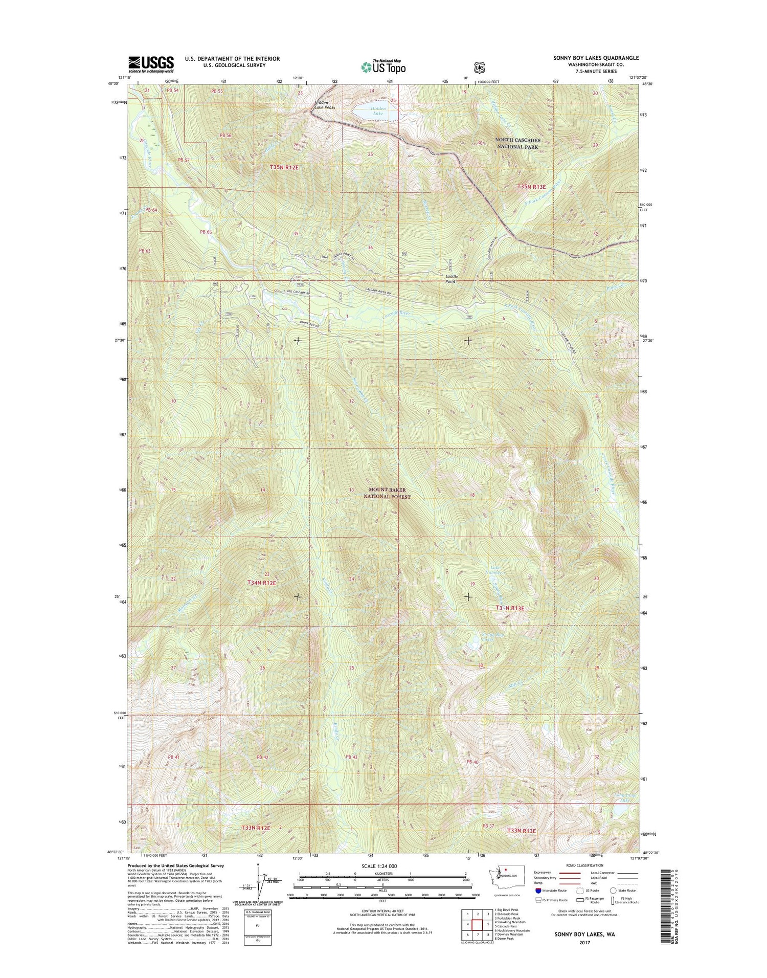
Sonny Boy Lakes Washington US Topo Map
Couldn't load pickup availability
Also explore the Sonny Boy Lakes Forest Service Topo of this same quad for updated USFS data
2023 topographic map quadrangle Sonny Boy Lakes in the state of Washington. Scale: 1:24000. Based on the newly updated USGS 7.5' US Topo map series, this map is in the following counties: Skagit. The map contains contour data, water features, and other items you are used to seeing on USGS maps, but also has updated roads and other features. This is the next generation of topographic maps. Printed on high-quality waterproof paper with UV fade-resistant inks.
Quads adjacent to this one:
West: Snowking Mountain
Northwest: Big Devil Peak
North: Eldorado Peak
Northeast: Forbidden Peak
East: Cascade Pass
Southeast: Dome Peak
South: Downey Mountain
Southwest: Huckleberry Mountain
This map covers the same area as the classic USGS quad with code o48121d2.
Contains the following named places: Barrett Creek, Found Creek, Hard Creek, Hidden Lake, Hidden Lake Creek, Hidden Lake Lookout, Kindy Creek, Lake Number 1, Lake Number 2, Long Gone Lake, Middle Fork Cascade River, Mineral Park, Mineral Park Campground, Mineral Park Guard Station, Mutchler Creek, North Fork Cascade River, Pincer Creek, Roush Creek, Saddle Point, Sonny Bay Creek, Sonny Boy Lakes, South Fork Cascade River, Swamp Creek, Vee Creek


