
MyTopo
Downey Mountain Washington US Topo Map
Couldn't load pickup availability
Also explore the Downey Mountain Forest Service Topo of this same quad for updated USFS data
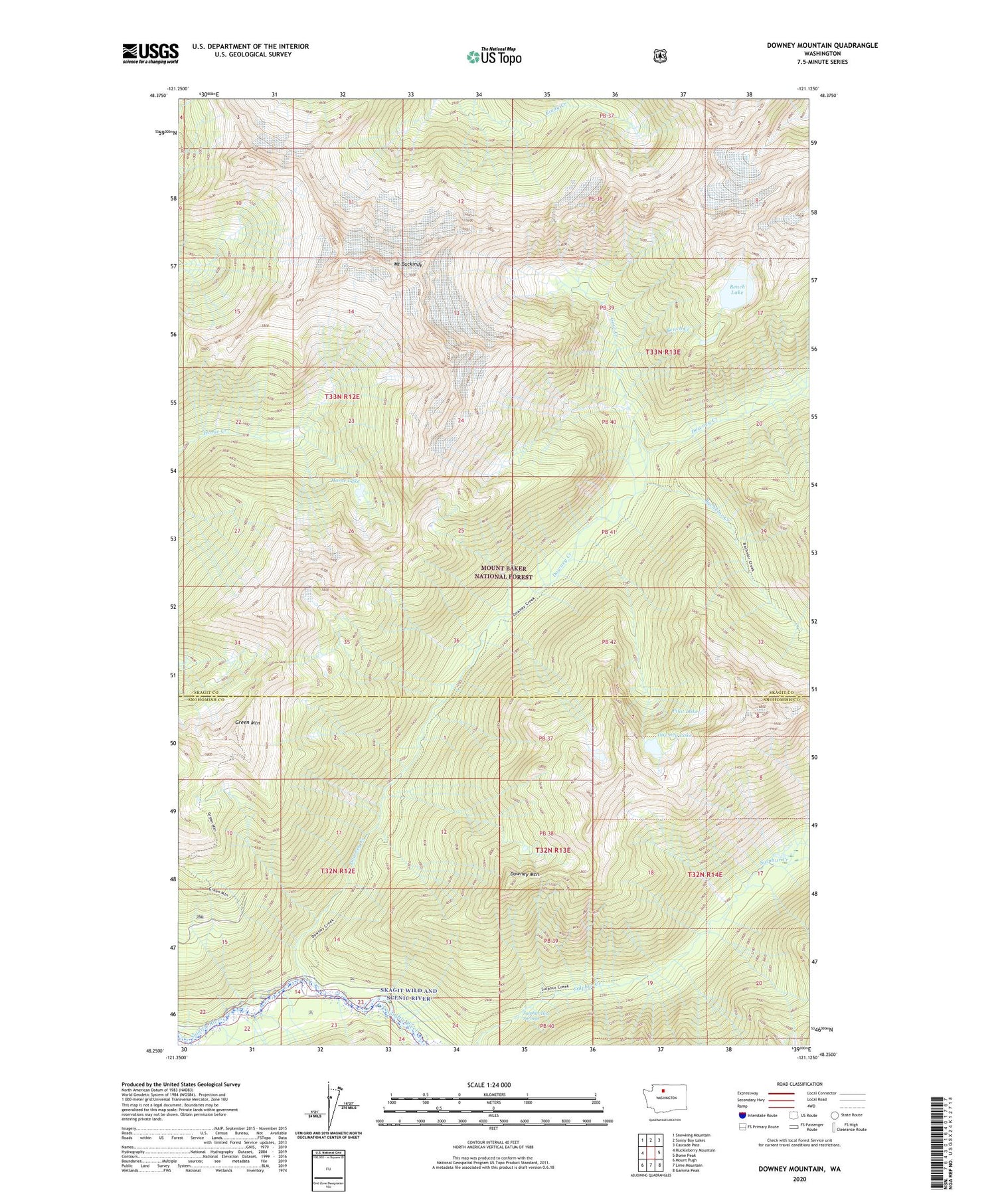
2023 topographic map quadrangle Downey Mountain in the state of Washington. Scale: 1:24000. Based on the newly updated USGS 7.5' US Topo map series, this map is in the following counties: Skagit, Snohomish. The map contains contour data, water features, and other items you are used to seeing on USGS maps, but also has updated roads and other features. This is the next generation of topographic maps. Printed on high-quality waterproof paper with UV fade-resistant inks.
Quads adjacent to this one:
West: Huckleberry Mountain
Northwest: Snowking Mountain
North: Sonny Boy Lakes
Northeast: Cascade Pass
East: Dome Peak
Southeast: Gamma Peak
South: Lime Mountain
Southwest: Mount Pugh
This map covers the same area as the classic USGS quad with code o48121c2.
Contains the following named places: Bachelor Creek, Bench Creek, Bench Lake, Downey Creek, Downey Creek Campground, Downey Lake, Downey Mountain, Downy Trailhead, Goat Creek, Green Mountain, Horse Lake, Mount Buckindy, Mount Misch, Pilot Lake, Sixmile Shelter, Sulphur Hot Springs


