MyTopo
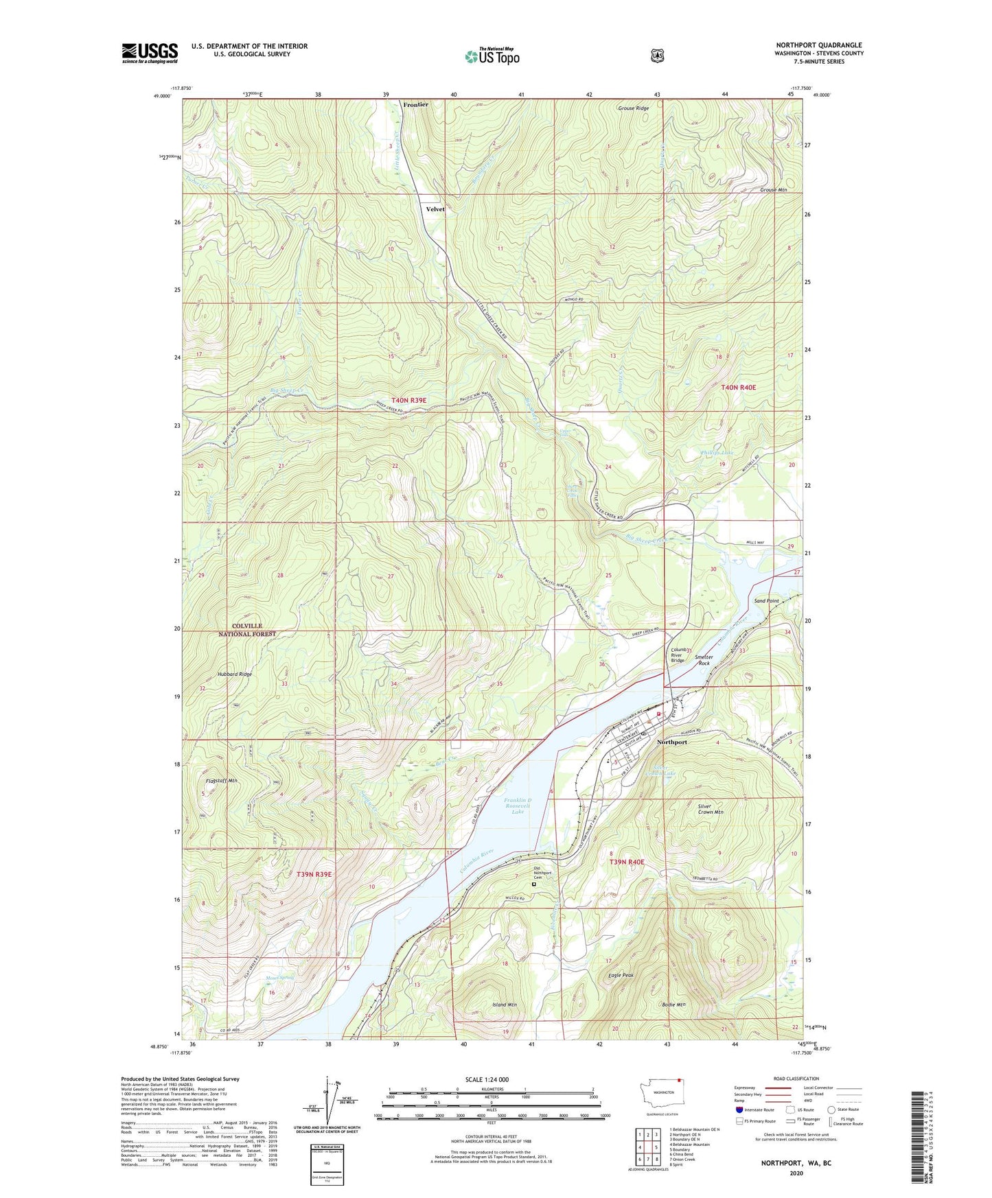
Northport Washington US Topo Map
Couldn't load pickup availability
Also explore the Northport Forest Service Topo of this same quad for updated USFS data
2023 topographic map quadrangle Northport in the state of Washington. Scale: 1:24000. Based on the newly updated USGS 7.5' US Topo map series, this map is in the following counties: Stevens. The map contains contour data, water features, and other items you are used to seeing on USGS maps, but also has updated roads and other features. This is the next generation of topographic maps. Printed on high-quality waterproof paper with UV fade-resistant inks.
Quads adjacent to this one:
West: Belshazzar Mountain
Northwest: Belshazzar Mountain OE N
North: Northport OE N
Northeast: Boundary OE N
East: Boundary
Southeast: Spirit
South: Onion Creek
Southwest: China Bend
This map covers the same area as the classic USGS quad with code o48117h7.
Contains the following named places: Bear Creek, Big Sheep Creek, Boundary Creek, Columbia River Bridge, Coyote Mine, Deep Creek, Double Standard Mine, Eagle Peak, Fivemile Creek, Flagstaff Mountain, Frontier, Frontier Port of Entry, Gold Creek, Great Republic Mine, Grouse Ridge, Hubbard Mine, Hubbard Ridge, Hudson, Island Mountain, Little Sheep Creek, Moses Spring, New Hope Assembly of God Church, Northport, Northport Community Health Center, Northport Community Library, Northport Post Office, Northport School, Northport Seventh Day Adventist Church, Old Northport Cemetery, Phillips Lake, Quartz Creek, Saint Crispen Mine, Sand Point, Sheep Creek Falls, Sheep Creek Recreation Site, Sherve Quarry, Silver Crown Lake, Silver Crown Mountain, Smelter Rock, Squaw Creek, Steamboat Rock, Stevens County Fire District 11 Northport Station 2, Town of Northport, Turner Creek, Upper Columbia RV Park and Campground, Upper Falls, Velvet