MyTopo
Stacker Butte Washington US Topo Map
Couldn't load pickup availability
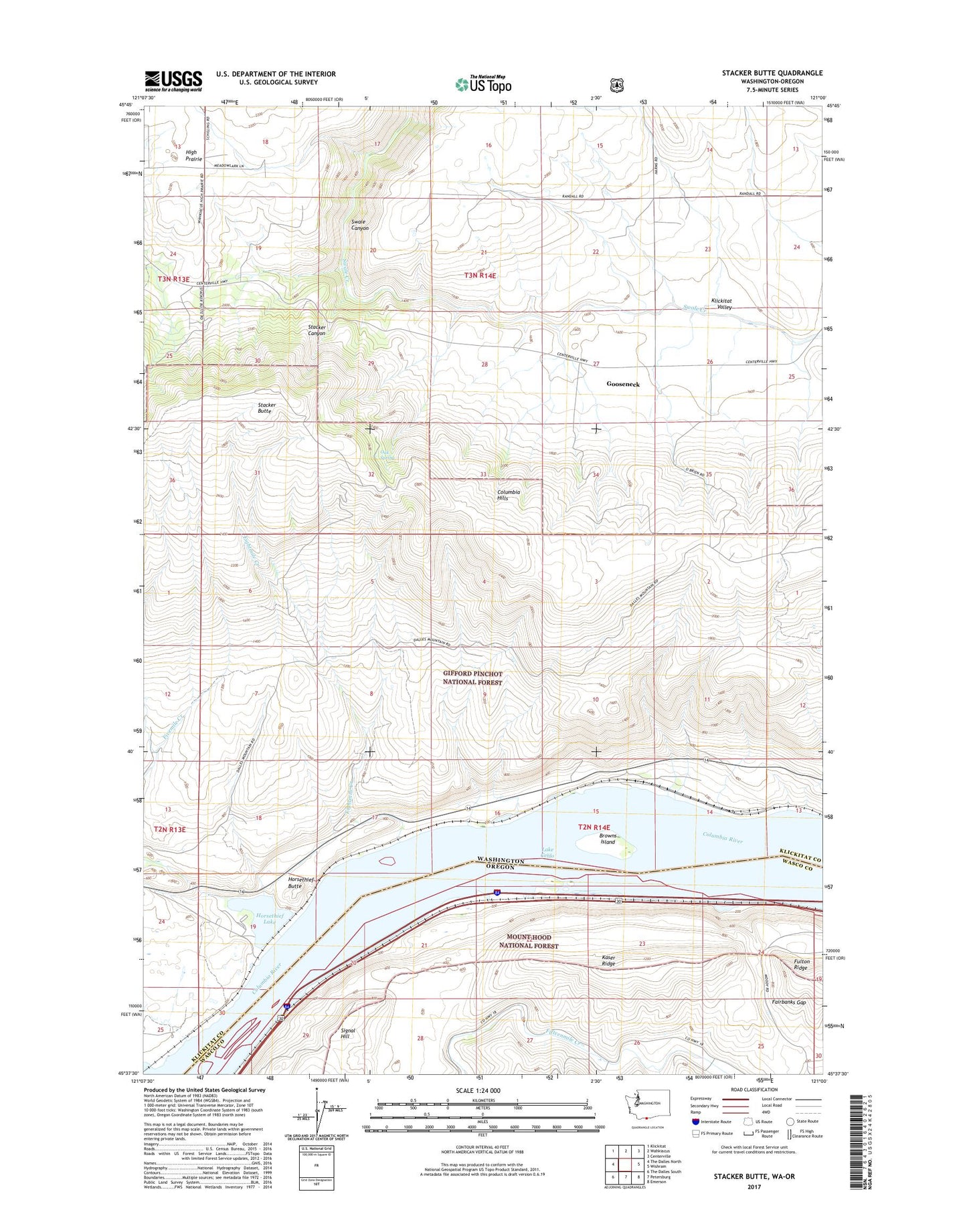
2020 topographic map quadrangle Stacker Butte in the states of Washington, Oregon. Scale: 1:24000. Based on the newly updated USGS 7.5' US Topo map series, this map is in the following counties: Klickitat, Wasco. The map contains contour data, water features, and other items you are used to seeing on USGS maps, but also has updated roads and other features. This is the next generation of topographic maps. Printed on high-quality waterproof paper with UV fade-resistant inks.
Quads adjacent to this one:
West: The Dalles North
Northwest: Klickitat
North: Wahkiacus
Northeast: Centerville
East: Wishram
Southeast: Emerson
South: Petersburg
Southwest: The Dalles South
Contains the following named places: Avery, Avery Recreation Area, Avery Treaty Fishing Access Site, Browns Island, Columbia Hills, Dune, Eightmile Creek, Fairbanks Gap, Fivemile Creek, Fivemile Lock Light, Fivemile Rapids, Fivemile Rapids Light, Gooseneck, Horsethief Butte, Horsethief Lake, Horsethief Lake State Park, Kaser Ridge, Lake Celilo, Memaloose Island Light, Mess House, Mile 7 Light, Oak Spring, Recreation Area, Stacker Butte, Stacker Canyon, Tenmile Rapids, The Dalles, The Dalles Unit, ZIP Code: 98673