MyTopo
Maytown Washington US Topo Map
Couldn't load pickup availability
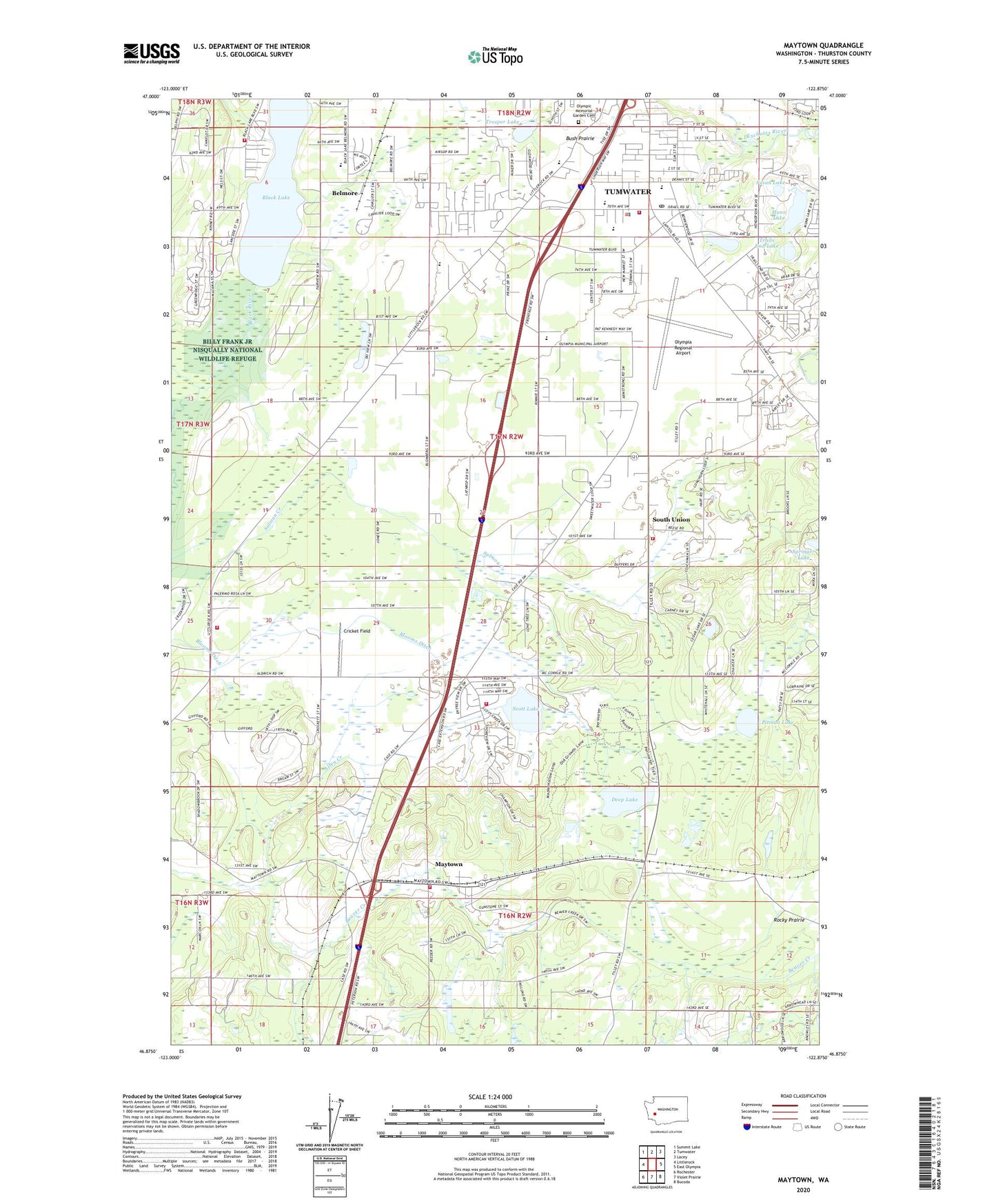
2023 topographic map quadrangle Maytown in the state of Washington. Scale: 1:24000. Based on the newly updated USGS 7.5' US Topo map series, this map is in the following counties: Thurston. The map contains contour data, water features, and other items you are used to seeing on USGS maps, but also has updated roads and other features. This is the next generation of topographic maps. Printed on high-quality waterproof paper with UV fade-resistant inks.
Quads adjacent to this one:
West: Littlerock
Northwest: Summit Lake
North: Tumwater
Northeast: Lacey
East: East Olympia
Southeast: Bucoda
South: Violet Prairie
Southwest: Rochester
This map covers the same area as the classic USGS quad with code o46122h8.
Contains the following named places: Allen Creek, Belmore, Black Lake, Black Lake Elementary School, Bush, Bush Prairie, City of Tumwater, Cricket Field, Deep Lake, Dempsey Creek, Maytown, McLane / Black Lake Fire Department Station 95, Millersylvania State Park, Mountain View Christian Church of the Nazarene, Munn Lake, Nazarene Christian School, Northwest Helicopters Heliport, Olympia Army Air Field, Olympia Regional Airport, Olympic Memorial Garden Cemetery, Peter G Schmidt Elementary School, Pitman Lake, Scott Lake, South Union, Springer Lake, Susan Lake, Thurston County Fire District 6 East Olympia Fire District Station 63, Trails End Lake, Trosper Lake, Tumwater Fire Department Headquarters, Tumwater High School, Tumwater Middle School, Tumwater Police Department, Tumwater Post Office, West Thurston Regional Fire Authority Central Battalion Station 1 - 6 Maytown, West Thurston Regional Fire Authority North Battalion Station 1 - 2 Littlerock, West Thurston Regional Fire Authority North Battalion Station 1 - 4 - Scott Lake, ZIP Code: 98501