MyTopo
Moclips Washington US Topo Map
Couldn't load pickup availability
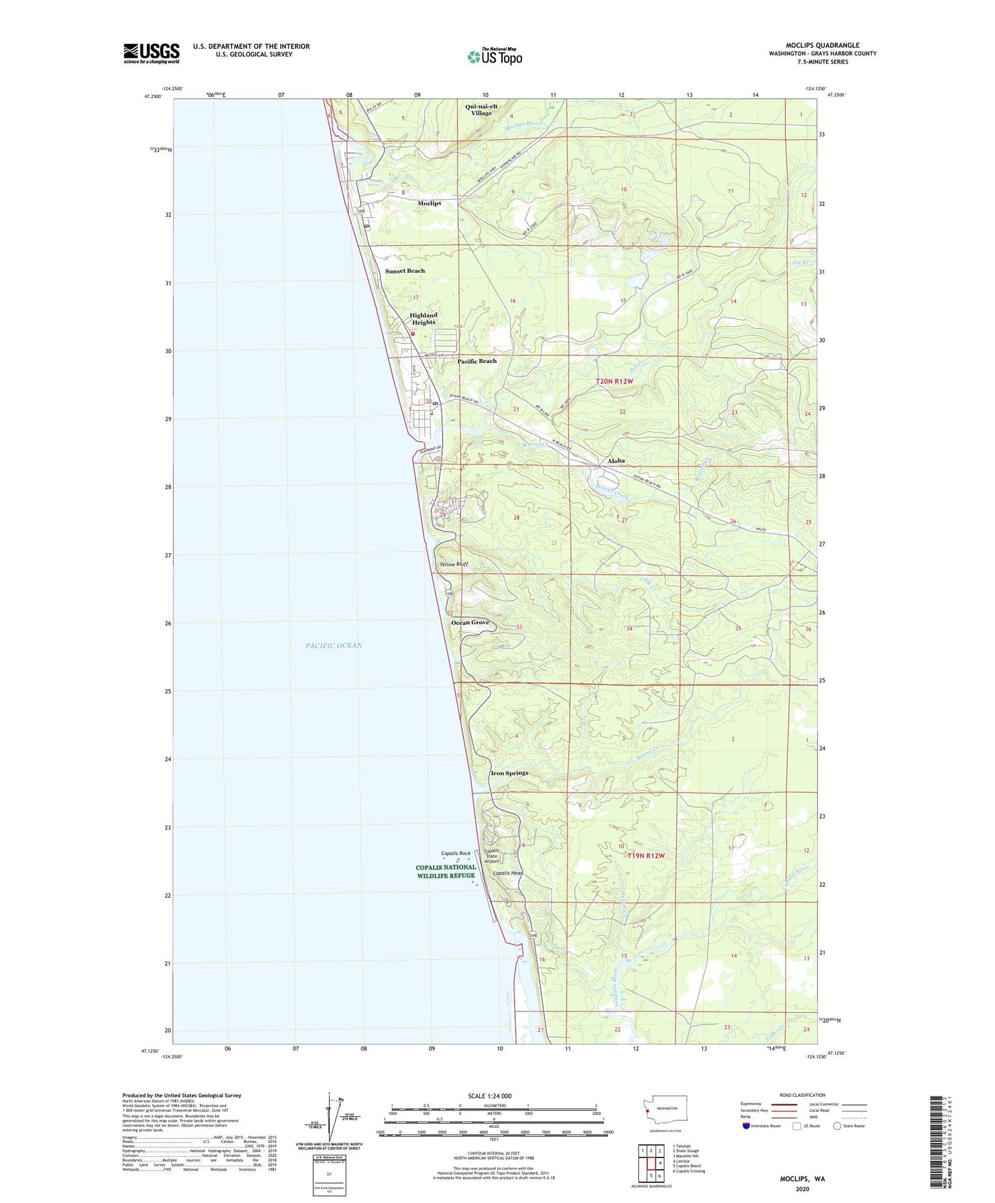
2023 topographic map quadrangle Moclips in the state of Washington. Scale: 1:24000. Based on the newly updated USGS 7.5' US Topo map series, this map is in the following counties: Grays Harbor. The map contains contour data, water features, and other items you are used to seeing on USGS maps, but also has updated roads and other features. This is the next generation of topographic maps. Printed on high-quality waterproof paper with UV fade-resistant inks.
Quads adjacent to this one:
Northwest: Taholah
North: Shale Slough
Northeast: Macafee Hill
East: Carlisle
Southeast: Copalis Crossing
South: Copalis Beach
This map covers the same area as the classic USGS quad with code o47124b2.
Contains the following named places: Aloha, Beaver Creek, Boone Creek, Copalis Head, Copalis River, Copalis Rock, Copalis State Airport, Elk Creek, Grays Harbor Fire District 8, Griffiths-Priday Ocean State Park, Highland Heights, Iron Springs, Joe Creek, Moclips, Moclips Aloha School, Moclips Census Designated Place, Moclips Post Office, Moclips River, Nelson Creek, North Fork Moclips River, Ocean Grove, Pacific Beach, Pacific Beach Census Designated Place, Pacific Beach Elementary School, Pacific Beach Post Office, Pacific Beach Resort and Conference Center, Pacific Beach Sewage Treatment Plant, Pacific Beach State Park, Roosevelt Beach, Stearnsville, Sunset Beach, Yellow Bluff, ZIP Codes: 98562, 98571