MyTopo
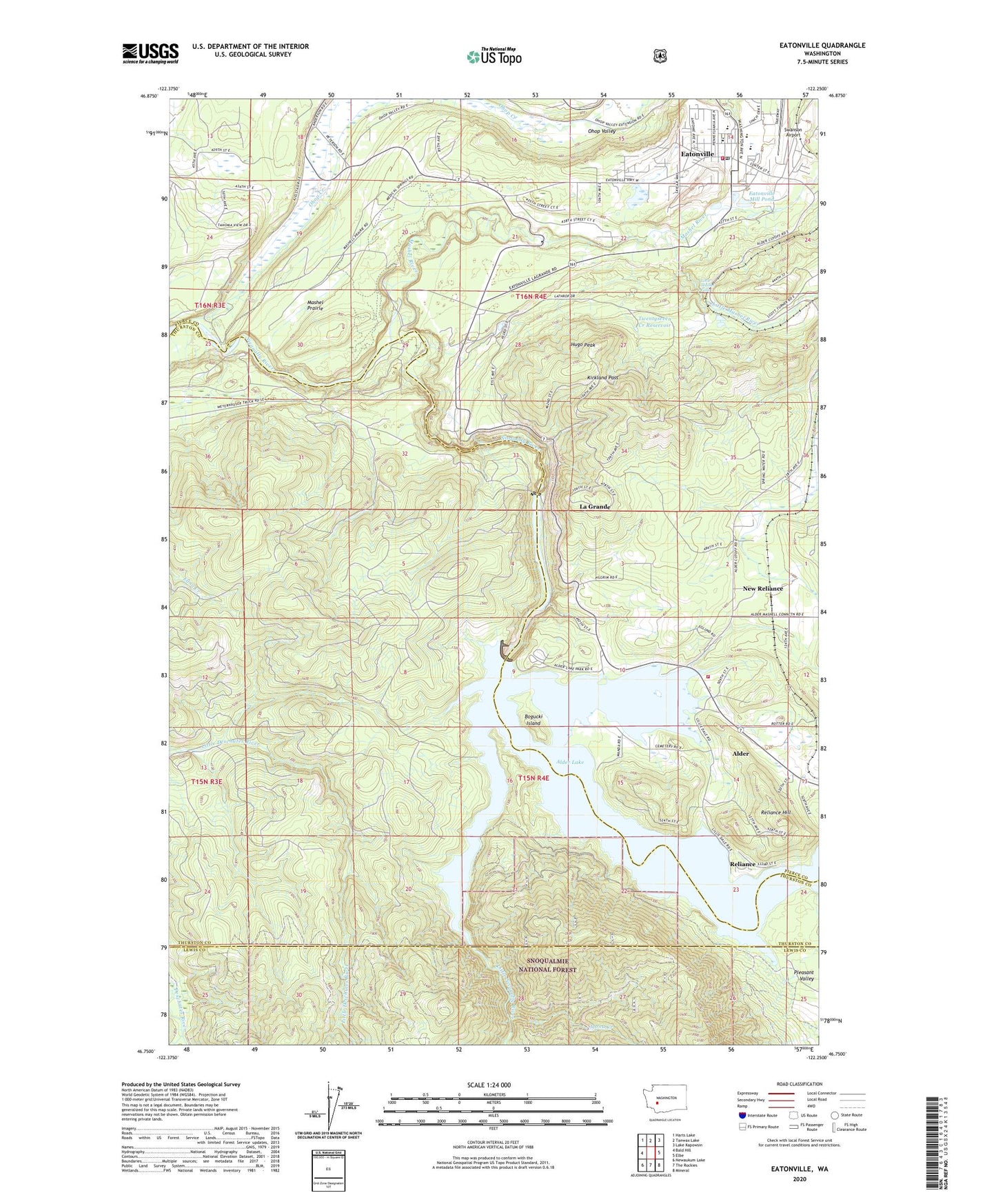
Eatonville Washington US Topo Map
Couldn't load pickup availability
Also explore the Eatonville Forest Service Topo of this same quad for updated USFS data
2023 topographic map quadrangle Eatonville in the state of Washington. Scale: 1:24000. Based on the newly updated USGS 7.5' US Topo map series, this map is in the following counties: Pierce, Thurston, Lewis. The map contains contour data, water features, and other items you are used to seeing on USGS maps, but also has updated roads and other features. This is the next generation of topographic maps. Printed on high-quality waterproof paper with UV fade-resistant inks.
Quads adjacent to this one:
West: Bald Hill
Northwest: Harts Lake
North: Tanwax Lake
Northeast: Lake Kapowsin
East: Elbe
Southeast: Mineral
South: The Rockies
Southwest: Newaukum Lake
This map covers the same area as the classic USGS quad with code o46122g3.
Contains the following named places: Alder, Alder Census Designated Place, Alder Dam, Alder Lake Campground, Bogucki Island, Charles Lathrop Pack Experimental and Demonstration Forest, Country Lane Mobile Home Park, Eatonville, Eatonville Early Learning Center, Eatonville Elementary School, Eatonville Fire Department, Eatonville High School, Eatonville Middle School, Eatonville Mill Pond, Eatonville Mill Pond Dam, Eatonville Police Department, Eatonville Post Office, Eatonville Sewage Treatment Plant, Elbe Ranger Station, Glacier View Park, Hugo Peak, Kirkland Pass, La Grande, La Grande Census Designated Place, La Grande Dam, La Grande Reservoir, Little Mashel Falls, Little Mashel River, Little Nisqually River, Mashel Prairie, Mashel River, Mill Village Mobile Home Park, Mona Creek, New Reliance, Ohop Bob, Ohop Creek, Ohop Valley, Pierce County Fire District 23 Station 3, Pleasant Valley, Reliance, Reliance Hill, Swanson Airport, Town of Eatonville, Twentyseven Creek Reservoir