MyTopo
Bucoda Washington US Topo Map
Couldn't load pickup availability
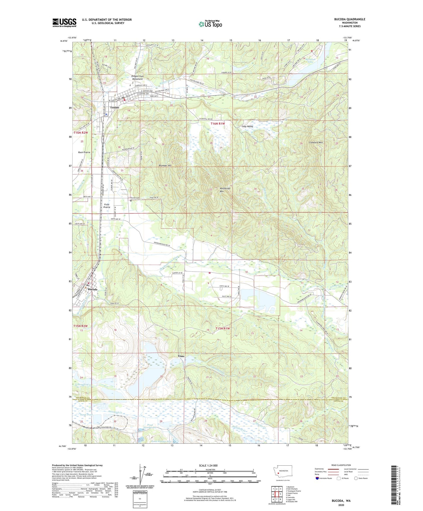
2023 topographic map quadrangle Bucoda in the state of Washington. Scale: 1:24000. Based on the newly updated USGS 7.5' US Topo map series, this map is in the following counties: Thurston, Lewis. The map contains contour data, water features, and other items you are used to seeing on USGS maps, but also has updated roads and other features. This is the next generation of topographic maps. Printed on high-quality waterproof paper with UV fade-resistant inks.
Quads adjacent to this one:
West: Violet Prairie
Northwest: Maytown
North: East Olympia
Northeast: Tenalquot Prairie
East: Vail
Southeast: Onalaska NW
South: Logan Hill
Southwest: Centralia
This map covers the same area as the classic USGS quad with code o46122g7.
Contains the following named places: Berger Dam, Black Prince Mine, Blumaer Hill, Bucoda, Bucoda Fire Department, Bucoda Grade School, Bucoda Post Office, Bucoda Volunteer Park, City of Tenino, Cozy Valley, Crawford Mountain, Dam Number One, Dam Number Six, Forest Grove Cemetery, Frost Prairie, Johnson Creek, McIntosh, McIntosh Lake, Memorial Swimming Pool, Northcraft Mountain, Oregon Trail Monument, Packwood Creek, Parkside Elementary School, Pond Number One, Pond Number Six, Salmon Creek, Snyder Creek, Southeast Thurston Fire Authority Station 25 - McIntosh Lake, Surge Pond, Surge Pond Dam, Tenino, Tenino Elementary School, Tenino High School, Tenino Junction, Tenino Middle School, Tenino Police Department, Tenino Post Office, Thompson Creek, Thurston County Fire District 12 Tenino Fire Department, Thurston County Fire District 12 Tenino Fire Department Station 12 - 3, Thurston South Division, Tono, Town of Bucoda, ZIP Codes: 98530, 98589