MyTopo
Riverside Washington US Topo Map
Couldn't load pickup availability
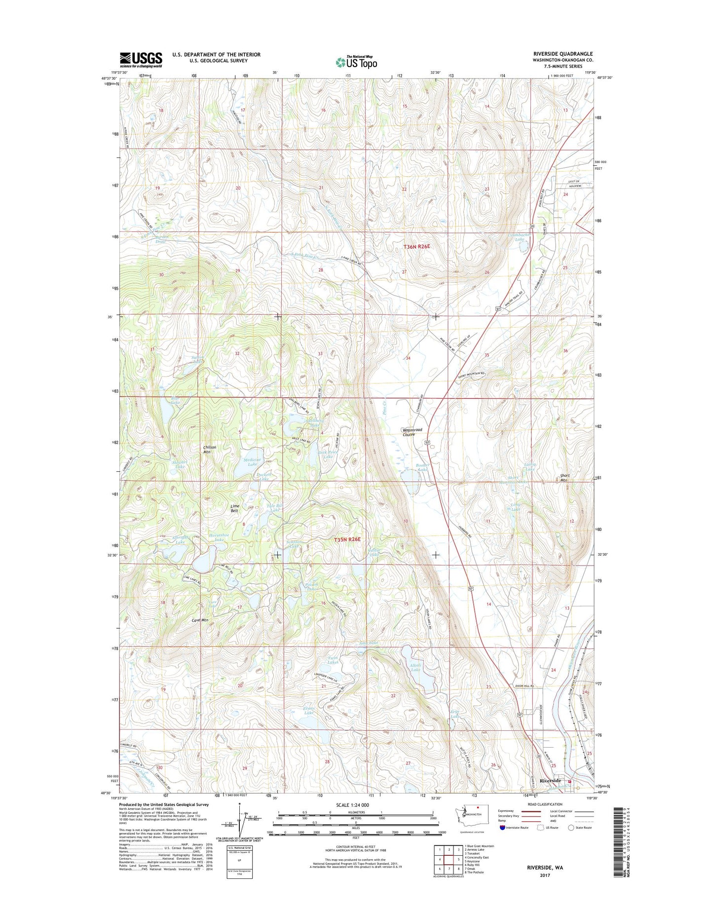
2023 topographic map quadrangle Riverside in the state of Washington. Scale: 1:24000. Based on the newly updated USGS 7.5' US Topo map series, this map is in the following counties: Okanogan. The map contains contour data, water features, and other items you are used to seeing on USGS maps, but also has updated roads and other features. This is the next generation of topographic maps. Printed on high-quality waterproof paper with UV fade-resistant inks.
Quads adjacent to this one:
West: Conconully East
Northwest: Blue Goat Mountain
North: Aeneas Lake
Northeast: Tonasket
East: Keystone
Southeast: The Pothole
South: Omak
Southwest: Ruby Hill
This map covers the same area as the classic USGS quad with code o48119e5.
Contains the following named places: Albright Lake, Alkali Lake, Amy Lake, Blue Lake, Booher Lake, Burden Draw, Castor Lake, Cave Lake, Cave Mountain, Chilson Mountain, Crumbacker Lake, Dick Price Lake, Duckett Lake, Evans Lake, Frye Lake, Horseshoe Lake, Johnson Creek, Lattig Lake, Lighthouse Chapel Assembly God Church, Lime Belt, Long Lake, Margie's Recreational Vehicle Park, Medicine Lake, North Fork Pine Creek, Okanogan County Fire District 7, Pine Creek, Poison Lake, Riverside, Scanlon Lake, Shellberg Lake, Short Mountain, Short Mountain Lake, South Fork Pine Creek, Stewart Lake, Sutton Lake, Town of Riverside, Tule Bill Lake, Twin Lakes, Wagonroad Coulee