MyTopo
Trinity Washington US Topo Map
Couldn't load pickup availability
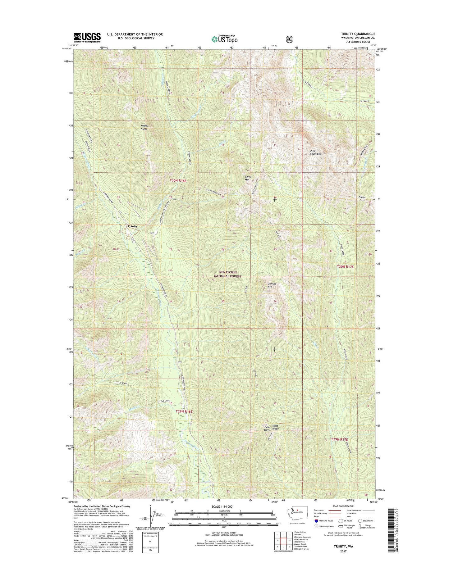
2020 topographic map quadrangle Trinity in the state of Washington. Scale: 1:24000. Based on the newly updated USGS 7.5' US Topo map series, this map is in the following counties: Chelan. The map contains contour data, water features, and other items you are used to seeing on USGS maps, but also has updated roads and other features. This is the next generation of topographic maps. Printed on high-quality waterproof paper with UV fade-resistant inks.
Quads adjacent to this one:
West: Clark Mountain
Northwest: Suiattle Pass
North: Holden
Northeast: Pinnacle Mountain
East: Saska Peak
Southeast: Chikamin Creek
South: Schaefer Lake
Southwest: Mount David
Contains the following named places: Alpine Creek, Alpine Meadows Campground, Box Creek, Carne Mountain, Chipmunk Creek, Estes Butte, Estes Ridge, Gib Creek, James Creek, Little Giant Creek, Maple Creek, Maple Creek Campground, Nineteenmile Campground, Old Gib Mountain, Phelps Creek, Phelps Creek Campground, Pomas Pass, Red Mountain Mine, Trinity, Willow Creek