MyTopo
Wellpinit Washington US Topo Map
Couldn't load pickup availability
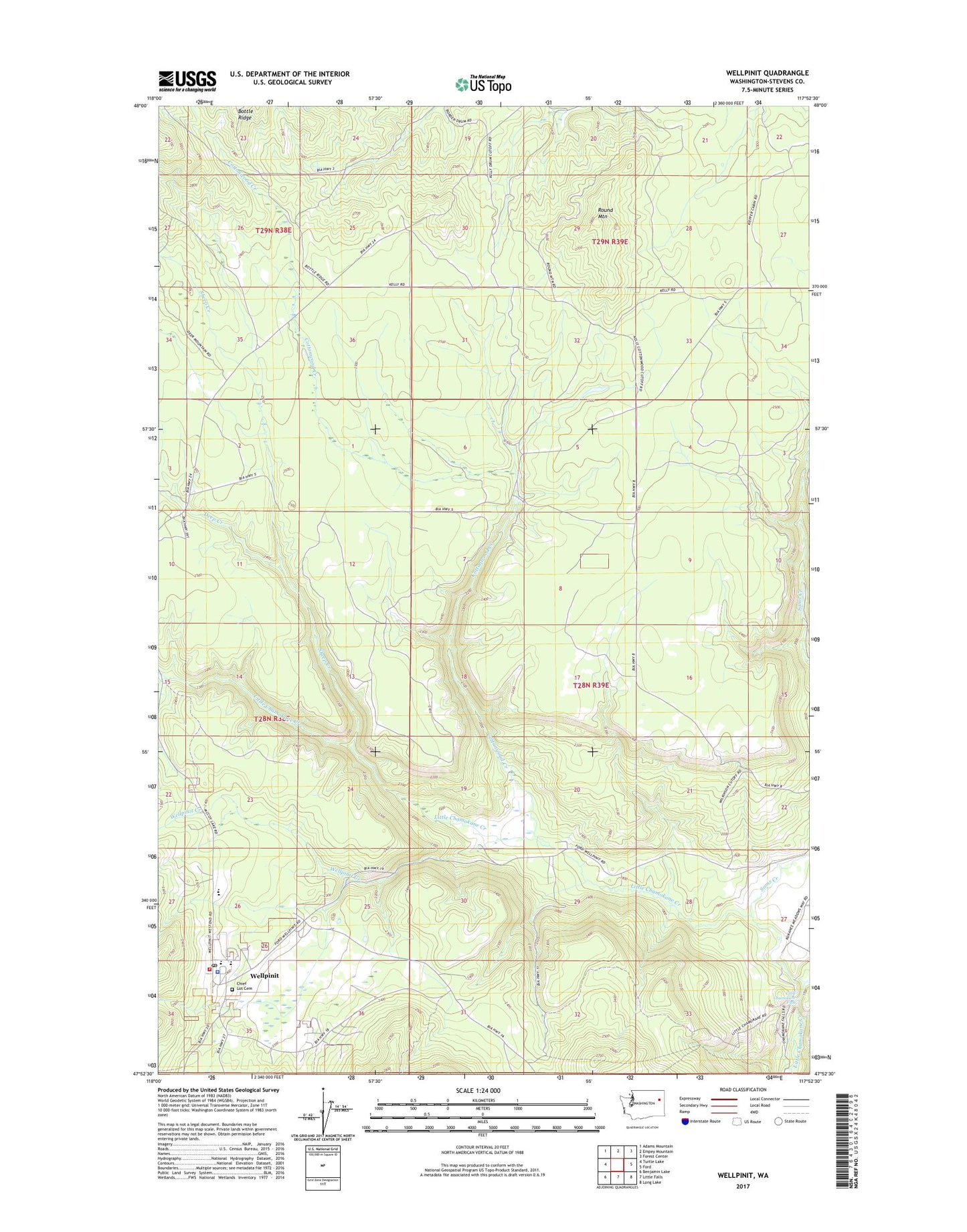
2023 topographic map quadrangle Wellpinit in the state of Washington. Scale: 1:24000. Based on the newly updated USGS 7.5' US Topo map series, this map is in the following counties: Stevens. The map contains contour data, water features, and other items you are used to seeing on USGS maps, but also has updated roads and other features. This is the next generation of topographic maps. Printed on high-quality waterproof paper with UV fade-resistant inks.
Quads adjacent to this one:
West: Turtle Lake
Northwest: Adams Mountain
North: Empey Mountain
Northeast: Forest Center
East: Ford
Southeast: Long Lake
South: Little Falls
Southwest: Benjamin Lake
This map covers the same area as the classic USGS quad with code o47117h8.
Contains the following named places: Bottle Ridge, Chief Lot Cemetery, Cottonwood Creek, Deep Creek, Little Chamokane Falls, Round Mountain, Sams Creek, Sheep Creek, Spokane Tribal Ambulance, Spokane Tribal Fire Department, Spokane Tribe of Indians Child Care Center, Wellpinit, Wellpinit Census Designated Place, Wellpinit Creek, Wellpinit High School, Wellpinit Police Department, Wellpinit Sanitation and Maintenance Wastewater Treatment Plant, Willipit Post Office