MyTopo
Tweedie Washington US Topo Map
Couldn't load pickup availability
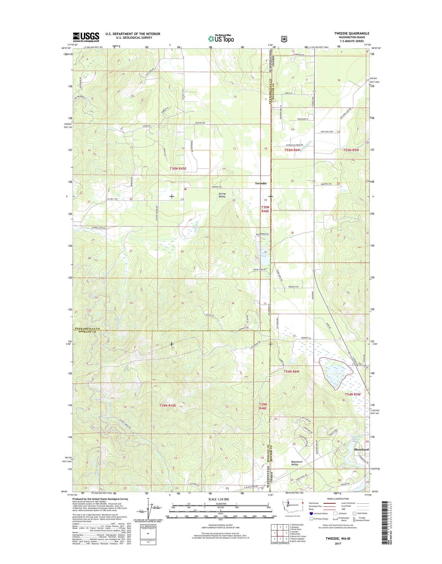
2020 topographic map quadrangle Tweedie in the states of Washington, Idaho. Scale: 1:24000. Based on the newly updated USGS 7.5' US Topo map series, this map is in the following counties: Pend Oreille, Bonner, Spokane. The map contains contour data, water features, and other items you are used to seeing on USGS maps, but also has updated roads and other features. This is the next generation of topographic maps. Printed on high-quality waterproof paper with UV fade-resistant inks.
Quads adjacent to this one:
West: Camden
Northwest: Diamond Lake
North: Newport
Northeast: Priest River
East: Blanchard
Southeast: Spirit Lake West
South: Mount Spokane
Southwest: Mount Kit Carson
Contains the following named places: Bensons Spur, Blanchard Creek Dam, Blanchard Valley, Elmer Creek, Lake San Souci, McDonald Creek, Pend Oreill Valley Seventh Day Adventist School, Pend Oreille Fire District 8, Spirit Valley, Spring Valley, Spring Valley Church, Stoneridge Dam, Trask Pond, Tweedie