MyTopo
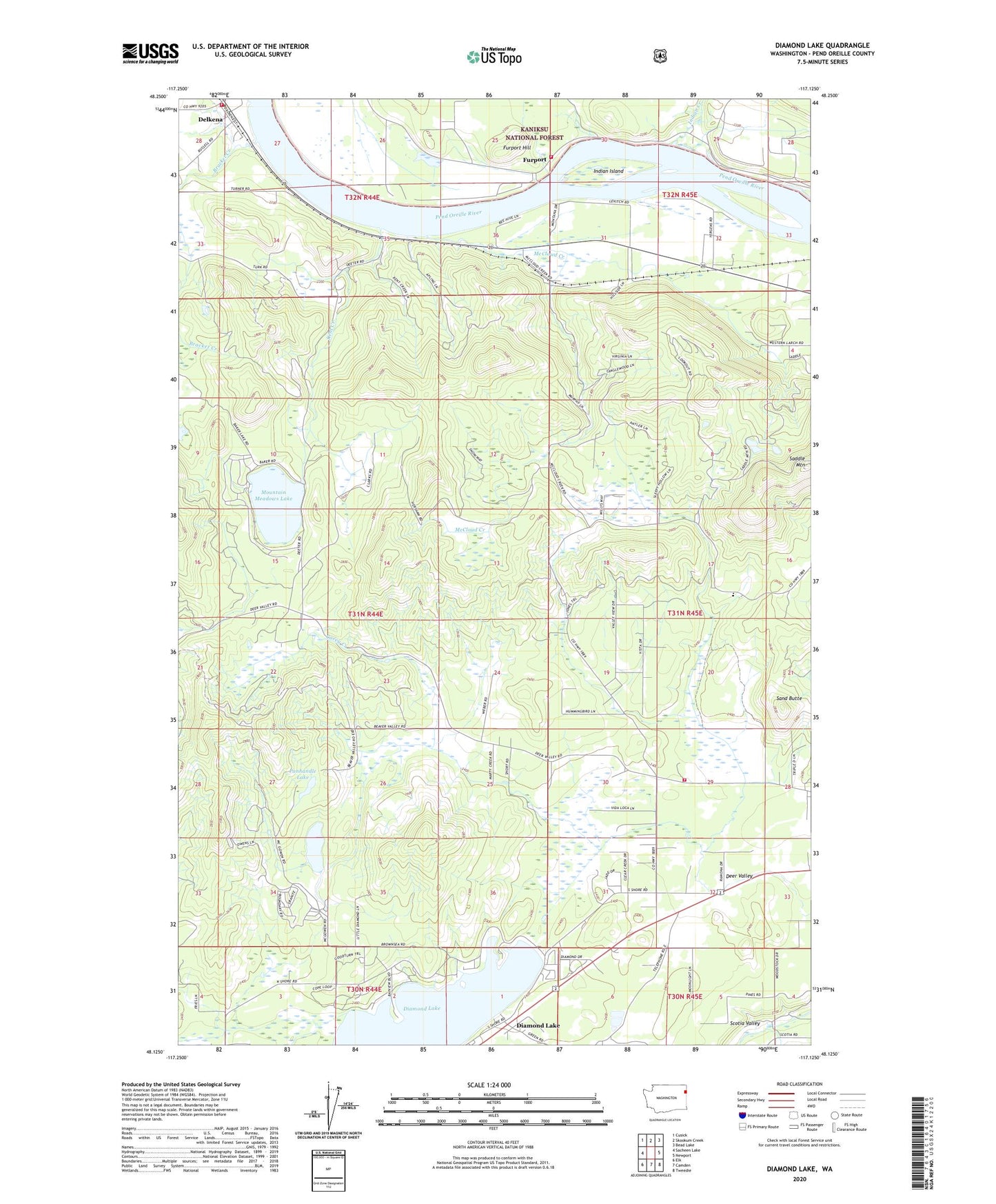
Diamond Lake Washington US Topo Map
Couldn't load pickup availability
Also explore the Diamond Lake Forest Service Topo of this same quad for updated USFS data
2023 topographic map quadrangle Diamond Lake in the state of Washington. Scale: 1:24000. Based on the newly updated USGS 7.5' US Topo map series, this map is in the following counties: Pend Oreille. The map contains contour data, water features, and other items you are used to seeing on USGS maps, but also has updated roads and other features. This is the next generation of topographic maps. Printed on high-quality waterproof paper with UV fade-resistant inks.
Quads adjacent to this one:
West: Sacheen Lake
Northwest: Cusick
North: Skookum Creek
Northeast: Bead Lake
East: Newport
Southeast: Tweedie
South: Camden
Southwest: Elk
This map covers the same area as the classic USGS quad with code o48117b2.
Contains the following named places: Bracket Creek, Camp Cowles, Carey Creek, Dalkena, Deer Valley, Delkena, Diamond Lake, Diamond Lake Water and Sewer District Wastewater Treatment Plant, Furport, Furport Hill, Indian Creek, Indian Island, Kent Creek, Kent Meadows Lake Dam, Lake Marney Dam, Lake Newport State Park, Mallard Marsh, McCloud Creek, Mountain Meadows Lake, Panhandle Lake, Pend Oreille Fire District 4 Station 41, Pend Oreille Fire District 6 and Rescue 6 Furport, Saddle Mountain, Sand Butte, South Pend Oreille Fire and Rescue Station 33 Deer Valley Road, Wolfred, Yergens and Anselmo Dam Number One, Yergens and Anselmo Dam Number Two, ZIP Code: 99156