MyTopo
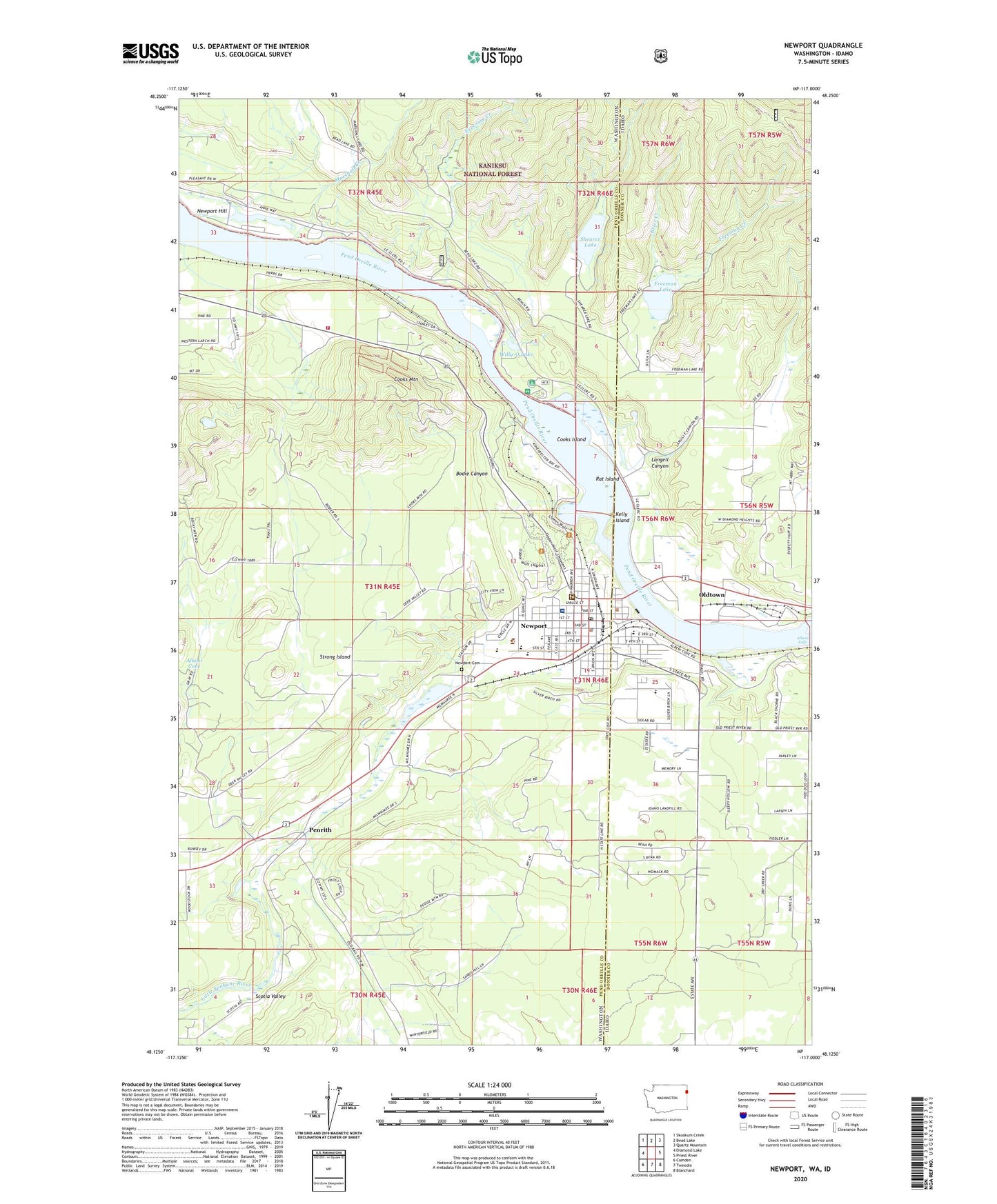
Newport Washington US Topo Map
Couldn't load pickup availability
Also explore the Newport Forest Service Topo of this same quad for updated USFS data
2023 topographic map quadrangle Newport in the states of Washington, Idaho. Scale: 1:24000. Based on the newly updated USGS 7.5' US Topo map series, this map is in the following counties: Pend Oreille, Bonner. The map contains contour data, water features, and other items you are used to seeing on USGS maps, but also has updated roads and other features. This is the next generation of topographic maps. Printed on high-quality waterproof paper with UV fade-resistant inks.
Quads adjacent to this one:
West: Diamond Lake
Northwest: Skookum Creek
North: Bead Lake
Northeast: Quartz Mountain
East: Priest River
Southeast: Blanchard
South: Tweedie
Southwest: Camden
This map covers the same area as the classic USGS quad with code o48117b1.
Contains the following named places: Albeni Cove, Albeni Falls, Albeni Falls Dam, American Lutheran Church, Bodie Canyon, Bodie Canyon Mine, Brier Creek, Church of Faith, City of Newport, City of Oldtown, Cooks Island, Cooks Mountain, Cuban Creek, Duncan Dam Number 1, Duncan Dam Number 2, Exposure Creek, First Baptist Church, Freeman Creek, Freeman Lake, Freeman Lake Access Area, House of the Lord Christian Academy, Idaho Hill Elementary School, Idaho School, Kelly Island, KUBS-FM (Newport), Langell Canyon, Lazy Acres Mobile Home Park, Lower West Branch Priest River, Marshall Creek, Newport, Newport Ambulance Service, Newport Cemetery, Newport City Hall, Newport City Police Department, Newport Community Hospital Heliport, Newport High School, Newport Hill, Newport Hospital and Health Services, Newport Landing Area, Newport Post Office, Newport Sewage Treatment Plant, Newport Southern Baptist Church, Oldtown, Pend Oreille County Courthouse, Pend Oreille County Hall of Justice, Pend Oreille Fire District 4 Station 42, Pend Oreille Sheriff's Office, Penrith, Pine Ridge Community Church, Pioneer Park, Rat Island, Saddler Creek, Sadie Halstead Middle School, Saint Anthony's Catholic Church, Shearer Lake, Stratton Elementary School, Strong Creek, Strong Island, United Church of Christ of Newport, Willy-O Lake, Willy-O Lake Dam


