MyTopo
Camden Washington US Topo Map
Couldn't load pickup availability
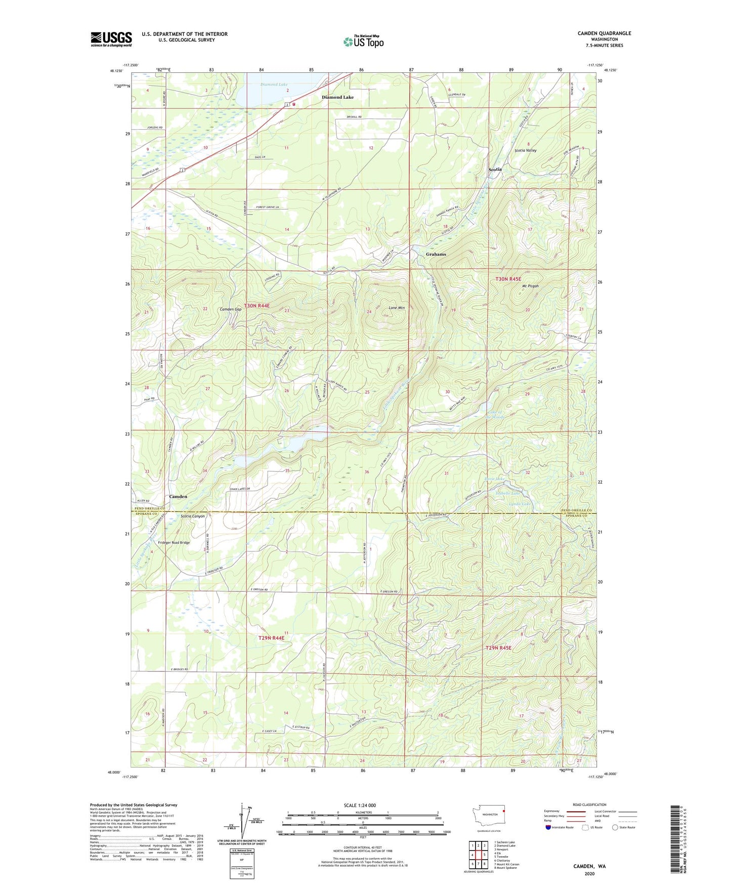
2023 topographic map quadrangle Camden in the state of Washington. Scale: 1:24000. Based on the newly updated USGS 7.5' US Topo map series, this map is in the following counties: Pend Oreille, Spokane. The map contains contour data, water features, and other items you are used to seeing on USGS maps, but also has updated roads and other features. This is the next generation of topographic maps. Printed on high-quality waterproof paper with UV fade-resistant inks.
Quads adjacent to this one:
West: Elk
Northwest: Sacheen Lake
North: Diamond Lake
Northeast: Newport
East: Tweedie
Southeast: Mount Spokane
South: Mount Kit Carson
Southwest: Chattaroy
This map covers the same area as the classic USGS quad with code o48117a2.
Contains the following named places: Camden, Camden Dam, Camden Gap, Chain Lake, Decie Lake, Decie Lake Dam, Diamond Lake, Diamond Lake Seventh Day Adventist Church, Frideger Road Bridge, Grahams, Isabelle Lake, Isabelle Lake Dam, Lake of the Woods, Lone Mountain, Lynda Lake, Lynda Lake Dam, Mount Pisgah, Scotia, Scotia Canyon, Scotia Valley, South Pend Oreille Fire and Rescue Station 31 - Diamond Lake, The Woods Lake Dam