MyTopo
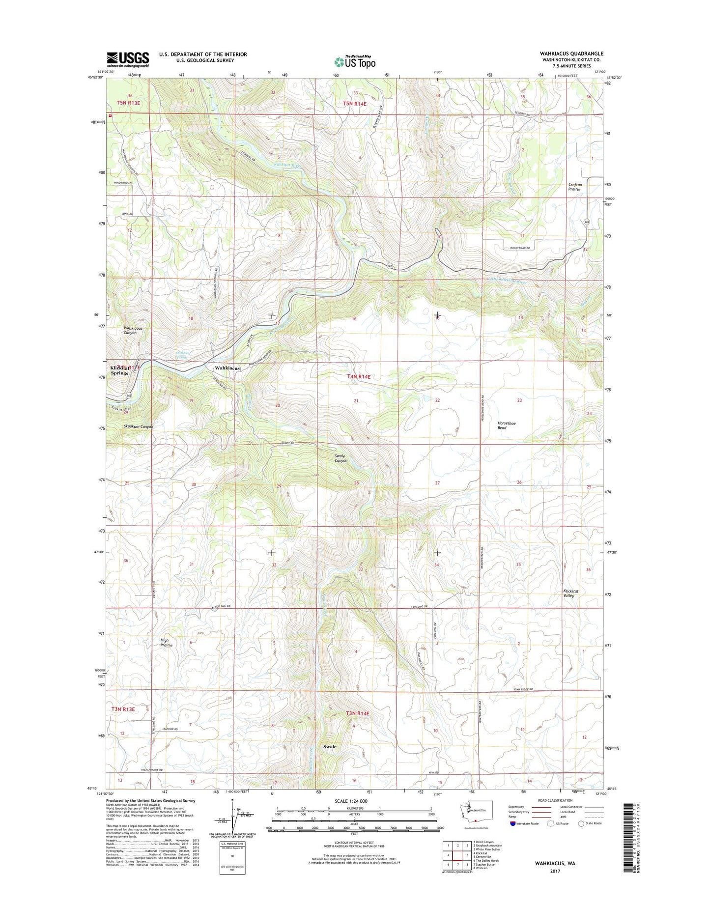
Wahkiacus Washington US Topo Map
Couldn't load pickup availability
2020 topographic map quadrangle Wahkiacus in the state of Washington. Scale: 1:24000. Based on the newly updated USGS 7.5' US Topo map series, this map is in the following counties: Klickitat. The map contains contour data, water features, and other items you are used to seeing on USGS maps, but also has updated roads and other features. This is the next generation of topographic maps. Printed on high-quality waterproof paper with UV fade-resistant inks.
Quads adjacent to this one:
West: Klickitat
Northwest: Dead Canyon
North: Grayback Mountain
Northeast: White Pine Buttes
East: Centerville
Southeast: Wishram
South: Stacker Butte
Southwest: The Dalles North
Contains the following named places: Bowman Creek, Canyon Creek, Horseshoe Bend, Klickitat County Fire District 15, Klickitat Springs, Little Klickitat River, Maddock Springs, Mill Creek, Swale, Swale Canyon, Swale Creek, Wahkiacus, Wahkiaous Canyon