MyTopo
Walla Walla Washington US Topo Map
Couldn't load pickup availability
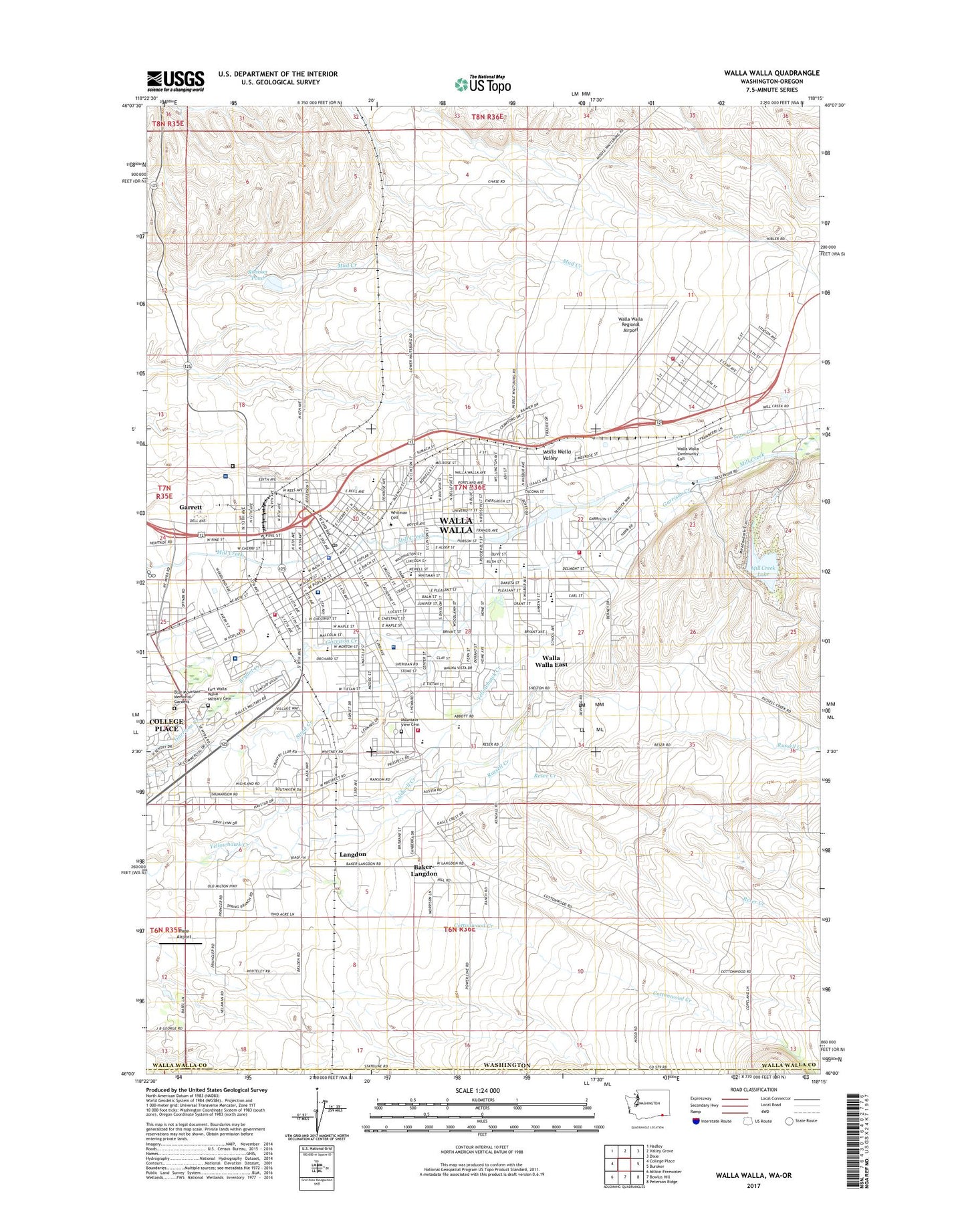
2023 topographic map quadrangle Walla Walla in the state of Washington. Scale: 1:24000. Based on the newly updated USGS 7.5' US Topo map series, this map is in the following counties: Walla Walla, Umatilla. The map contains contour data, water features, and other items you are used to seeing on USGS maps, but also has updated roads and other features. This is the next generation of topographic maps. Printed on high-quality waterproof paper with UV fade-resistant inks.
Quads adjacent to this one:
West: College Place
Northwest: Hadley
North: Valley Grove
Northeast: Dixie
East: Buroker
Southeast: Peterson Ridge
South: Bowlus Hill
Southwest: Milton-Freewater
This map covers the same area as the classic USGS quad with code o46118a3.
Contains the following named places: Assumption School, Baker-Langdon, Berney Elementary School, Blue Mountain Memorial Gardens, Blue Ridge Elementary School, Borleske Stadium, Braden School, Bryant Creek, Caldwell Creek, City of Walla Walla, Cottonwood Creek, Desales Catholic High School, DeSales Junior-Senior High School, Eastgate Mall, Eastgate Shopping Center, Edison Elementary School, Fort Walla Walla Military Cemetery, Fort Walla Walla Park, Garrison Middle School, Green Park Elementary School, Green Park Playground, Jefferson Park, Jefferson School, Jonathan M Wainwright Memorial Veterans Affairs Medical Center, KHSS-FM (Walla Walla), KSMX-AM (Walla Walla), KTEL-AM (Walla Walla), KWCW-FM (Walla Walla), Langdon, Lions Park, Mill Creek Channel, Mill Creek Dam, Mill Creek Diversion Dam, Mill Creek Lake, Mill Creek Reservation State Wildlife Recreation Area, Mountain View Cemetery, Page Airport, Pioneer Middle School, Pioneer Park, Plaza Shopping Center, Prospect Point Elementary School, Providence Saint Mary Medical Center, Reser Creek, Riffle, Robison Dam, Robison Pond, Russell Creek, Saint Patricks School, Saint Pauls School, Sharpstein Elementary School, Sky Ranch Landing Strip, Southgate Shopping Center, State Penitentiary Hospital, Tietan Park, Titus Creek, Tracy Junction, Twin Reservoirs Dam, Veterans Memorial Park and Golf Course, Vocational Technical School, Walla Walla, Walla Walla Army Air Field, Walla Walla Community College, Walla Walla Country Club, Walla Walla County Fire District 4 Airport Station, Walla Walla County Fire District 4 Station 41, Walla Walla County Fire District 4 Station 43, Walla Walla East Census Designated Place, Walla Walla Fire / Ambulance, Walla Walla General Hospital / Adventist Health, Walla Walla General Hospital Heliport, Walla Walla High School, Walla Walla Police Department, Walla Walla Post Office, Walla Walla Ranger Station, Walla Walla Regional Airport, Walla Walla Sheriff's Office, Walla Walla-College Place Division, Washington School, Washington State Penitentiary, Whitman College, Whitney, Wildwood Park, ZIP Code: 99362