MyTopo
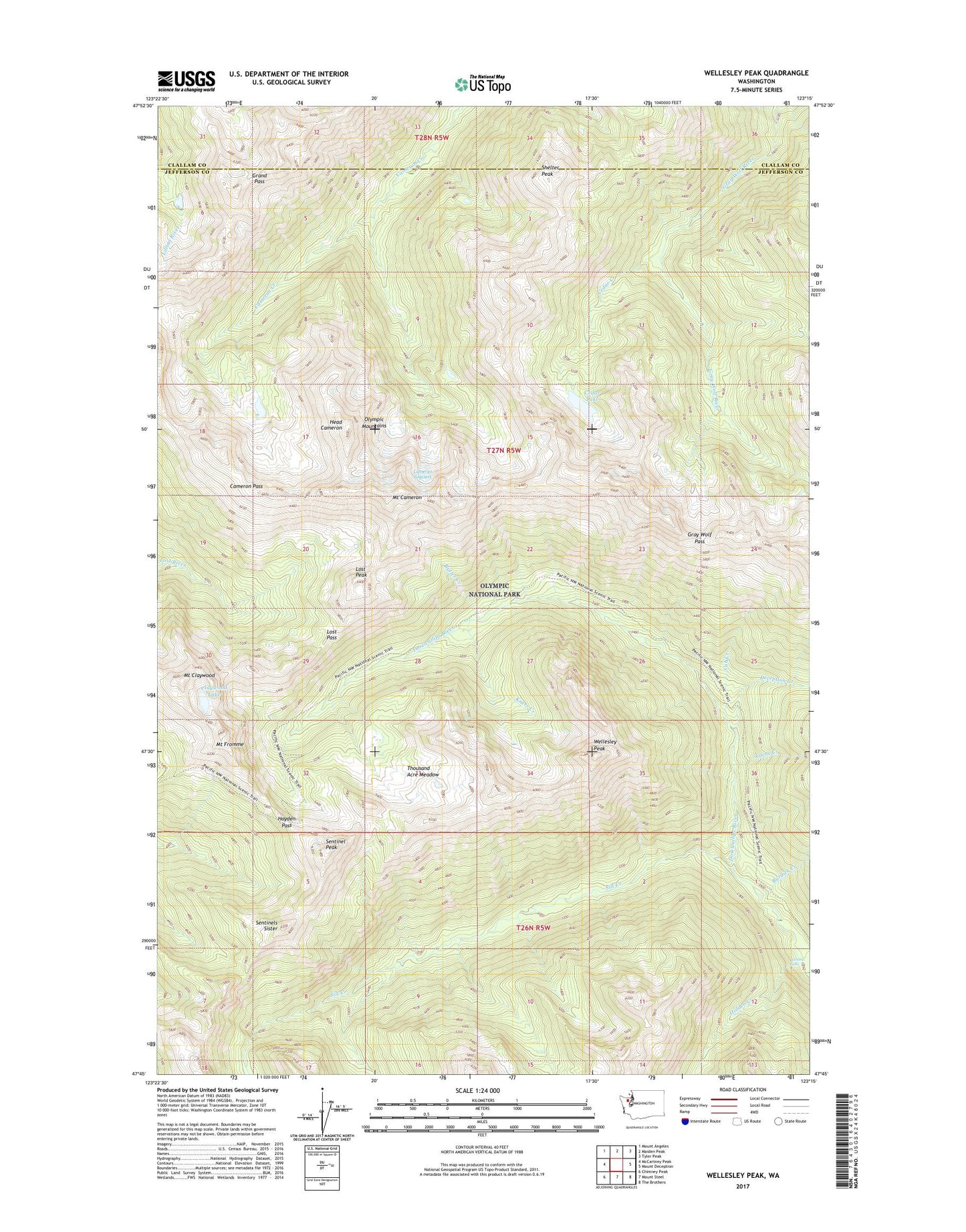
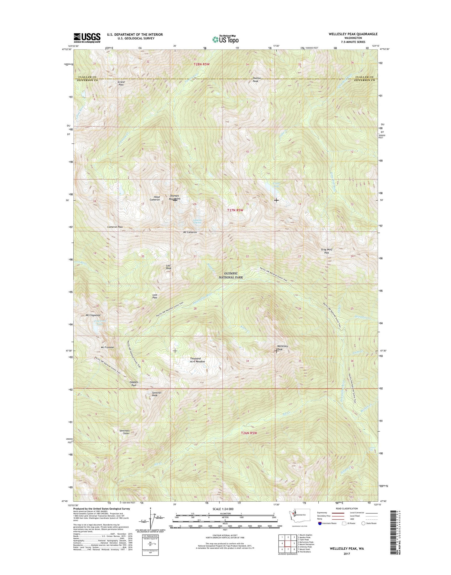
Wellesley Peak Washington US Topo Map
Couldn't load pickup availability
2020 topographic map quadrangle Wellesley Peak in the state of Washington. Scale: 1:24000. Based on the newly updated USGS 7.5' US Topo map series, this map is in the following counties: Jefferson, Clallam. The map contains contour data, water features, and other items you are used to seeing on USGS maps, but also has updated roads and other features. This is the next generation of topographic maps. Printed on high-quality waterproof paper with UV fade-resistant inks.
Quads adjacent to this one:
West: McCartney Peak
Northwest: Mount Angeles
North: Maiden Peak
Northeast: Tyler Peak
East: Mount Deception
Southeast: The Brothers
South: Mount Steel
Southwest: Chimney Peak
Contains the following named places: Bear Camp, Burdick Creek, Butler Creek, Cache Creek, Cameron Glaciers, Cameron Pass, Camp Marion, Cedar Creek, Cedar Lake, Claywood Lake, Cub Creek, Deception Creek, Dose Meadow Camp, Grand Pass, Gray Wolf Pass, Hatana Falls, Hayden Pass, Head Cameron, Hidden Creek, Knerr Creek, Lost Pass, Lost Peak, Mount Cameron, Mount Claywood, Mount Fromme, Sentinel Peak, Sentinels Sister, Shelter Peak, Silt Creek, Thousand Acre Meadow, Wellesley Peak