MyTopo
Wenas Lake Washington US Topo Map
Couldn't load pickup availability
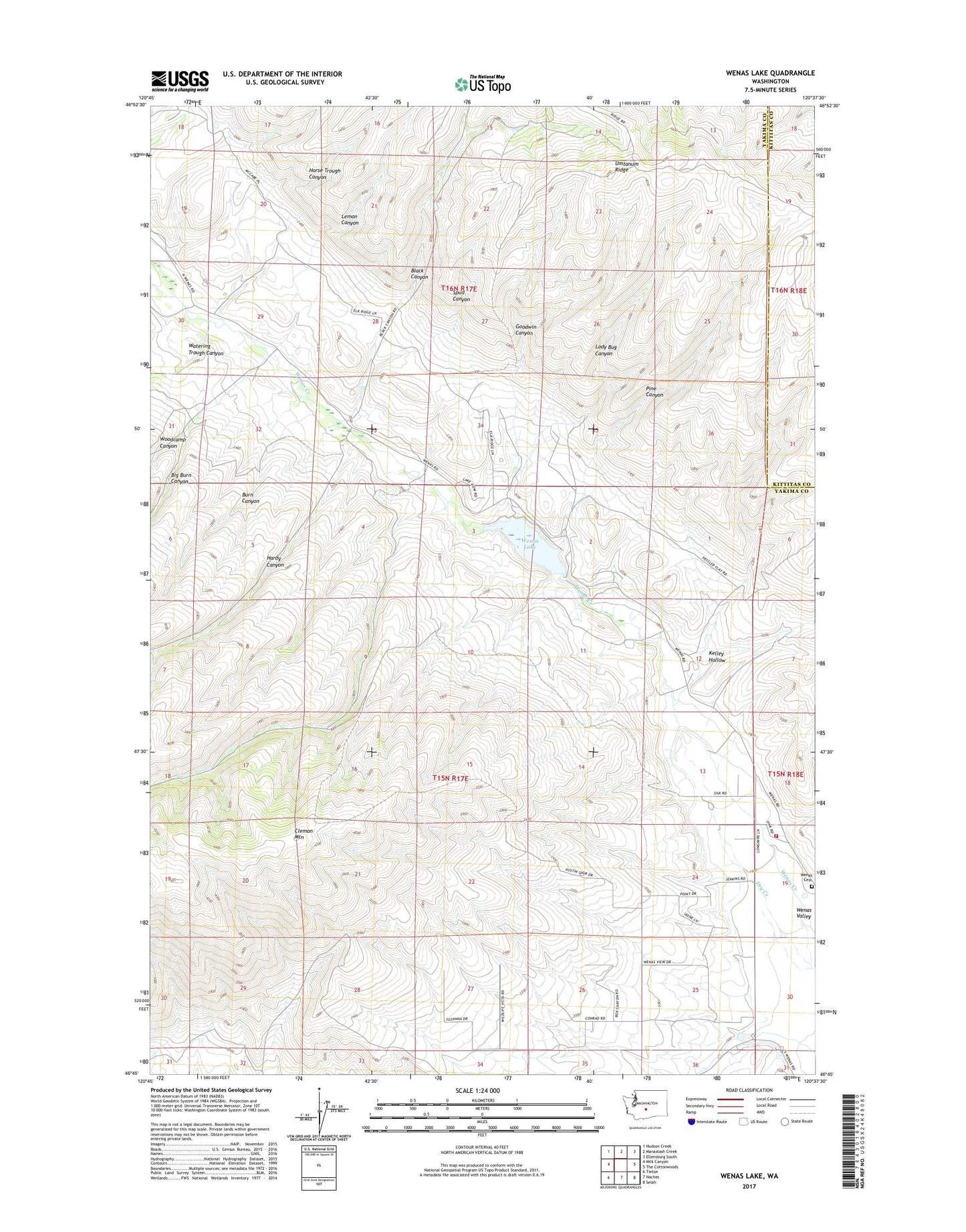
2023 topographic map quadrangle Wenas Lake in the state of Washington. Scale: 1:24000. Based on the newly updated USGS 7.5' US Topo map series, this map is in the following counties: Yakima, Kittitas. The map contains contour data, water features, and other items you are used to seeing on USGS maps, but also has updated roads and other features. This is the next generation of topographic maps. Printed on high-quality waterproof paper with UV fade-resistant inks.
Quads adjacent to this one:
West: Milk Canyon
Northwest: Hudson Creek
North: Manastash Creek
Northeast: Ellensburg South
East: The Cottonwoods
Southeast: Selah
South: Naches
Southwest: Tieton
This map covers the same area as the classic USGS quad with code o46120g6.
Contains the following named places: Big Burn Canyon, Black Canyon, Burn Canyon, Goodwin Canyon, Hardy Canyon, Horse Trough Canyon, Kelley Hollow, Lady Bug Canyon, Lemon Canyon, Pine Canyon, Reids Field, Spud Canyon, Watering Trough Canyon, Wenas Cemetery, Wenas Dam, Wenas Lake, Woodcamp Canyon, Yakima County Fire District 2 Selah Fire Department Station 26, ZIP Code: 98942