MyTopo
Wilkeson Washington US Topo Map
Couldn't load pickup availability
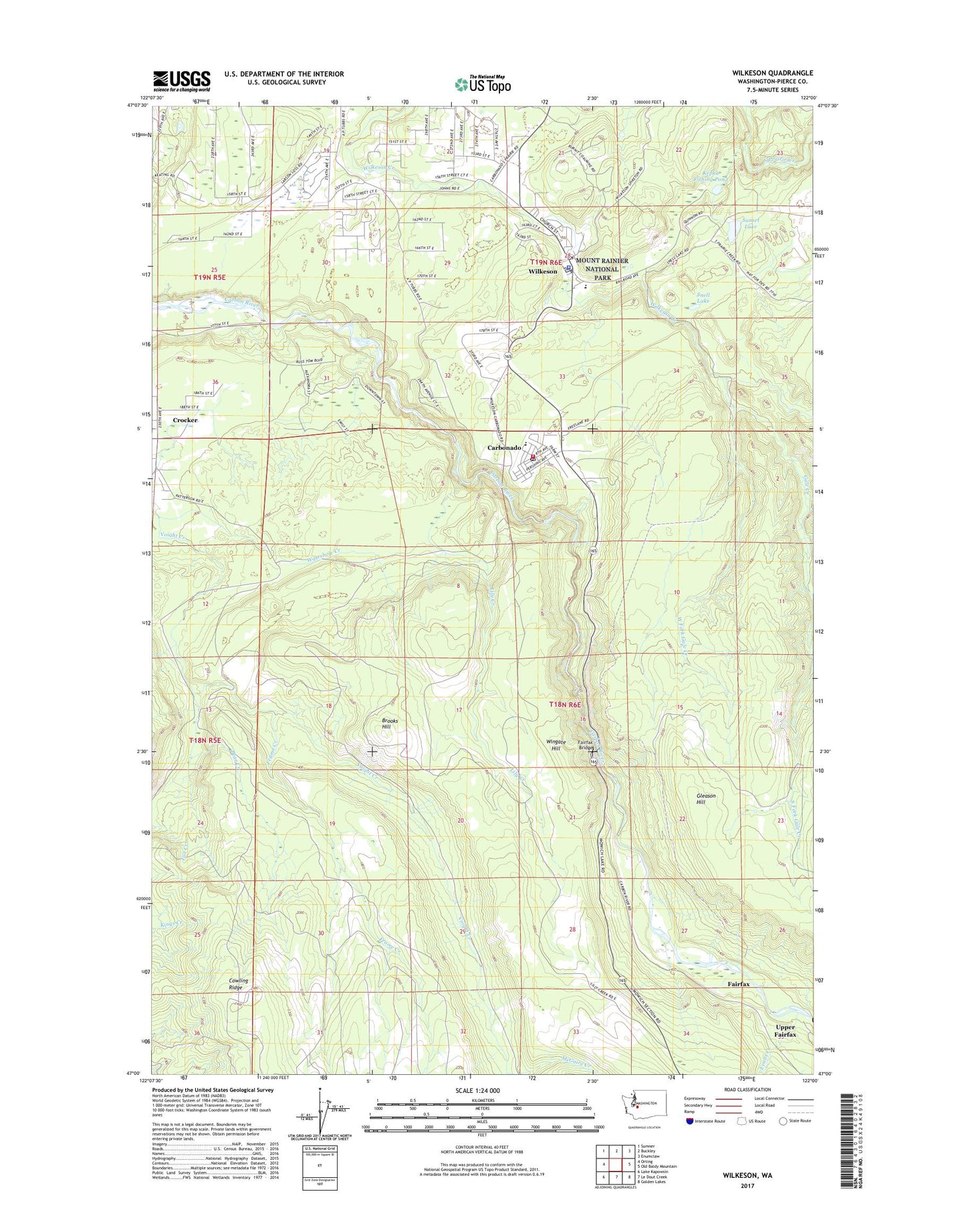
2020 topographic map quadrangle Wilkeson in the state of Washington. Scale: 1:24000. Based on the newly updated USGS 7.5' US Topo map series, this map is in the following counties: Pierce. The map contains contour data, water features, and other items you are used to seeing on USGS maps, but also has updated roads and other features. This is the next generation of topographic maps. Printed on high-quality waterproof paper with UV fade-resistant inks.
Quads adjacent to this one:
West: Orting
Northwest: Sumner
North: Buckley
Northeast: Enumclaw
East: Old Baldy Mountain
Southeast: Golden Lakes
South: Le Dout Creek
Southwest: Lake Kapowsin
Contains the following named places: Bear Creek, Brooks Hill, Carbonado, Carbonado Fire Department, Carbonado Historical School 19, Carbonado Post Office, Carbonado Sewage Treatment Plant, Cowling Ridge, Crocker Census Designated Place, East Pierce Fire Protection District 22 East Pierce Fire and Rescue Station 110 Wilkeson, Electron Lookout, Evans Creek, Fairfax, Fairfax Bridge, Frame Creek, Gale Creek, Gleason Hill, Kepka Fishing Pond, Kepka Lake Dam, Lily Creek, McGuire Creek, Page Creek, Snell Lake, Sunset Lake, Sunset Lake Dam, Town of Carbonado, Town of Wilkeson, Upper Fairfax, Waterhole Creek, West Fork Gale Creek, Wilkeson, Wilkeson Elementary School, Wilkeson Post Office, Wilkeson Sewage Treatment Plant, Wilkeson Town Police Department, Wingate Hill, ZIP Code: 98396