MyTopo
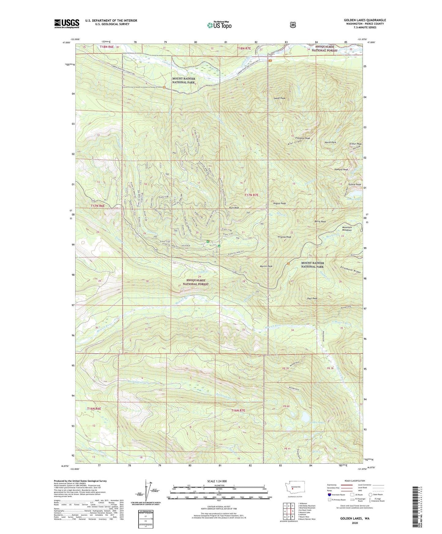
Golden Lakes Washington US Topo Map
Couldn't load pickup availability
Also explore the Golden Lakes Forest Service Topo of this same quad for updated USFS data
2023 topographic map quadrangle Golden Lakes in the state of Washington. Scale: 1:24000. Based on the newly updated USGS 7.5' US Topo map series, this map is in the following counties: Pierce. The map contains contour data, water features, and other items you are used to seeing on USGS maps, but also has updated roads and other features. This is the next generation of topographic maps. Printed on high-quality waterproof paper with UV fade-resistant inks.
Quads adjacent to this one:
West: Le Dout Creek
Northwest: Wilkeson
North: Old Baldy Mountain
Northeast: Bearhead Mountain
East: Mowich Lake
Southeast: Mount Rainier West
South: Mount Wow
Southwest: Ashford
This map covers the same area as the classic USGS quad with code o46121h8.
Contains the following named places: Alki Crest, August Peak, Berry Peak, Boundary Trail, Carbon River Entrance, Carbon River Ranger Station, Crater Creek, Eunice Lake, Florence Peak, Golden Lakes, Grindstone, Hayden Creek, Howard Peak, June Creek, Martin Peak, Meadow Creek, Mountain Meadows, Mowich Lake Entrance, North Mowich River, North Park, Paul Peak, Paul Peak Trail, Poch Creek, Poch Peak, South Mowich River, Spray Creek, Sunset Park, Sweet Peak, Tolmie Creek, Tolmie Peak, Virginia Peak, Wonderland Trail