MyTopo
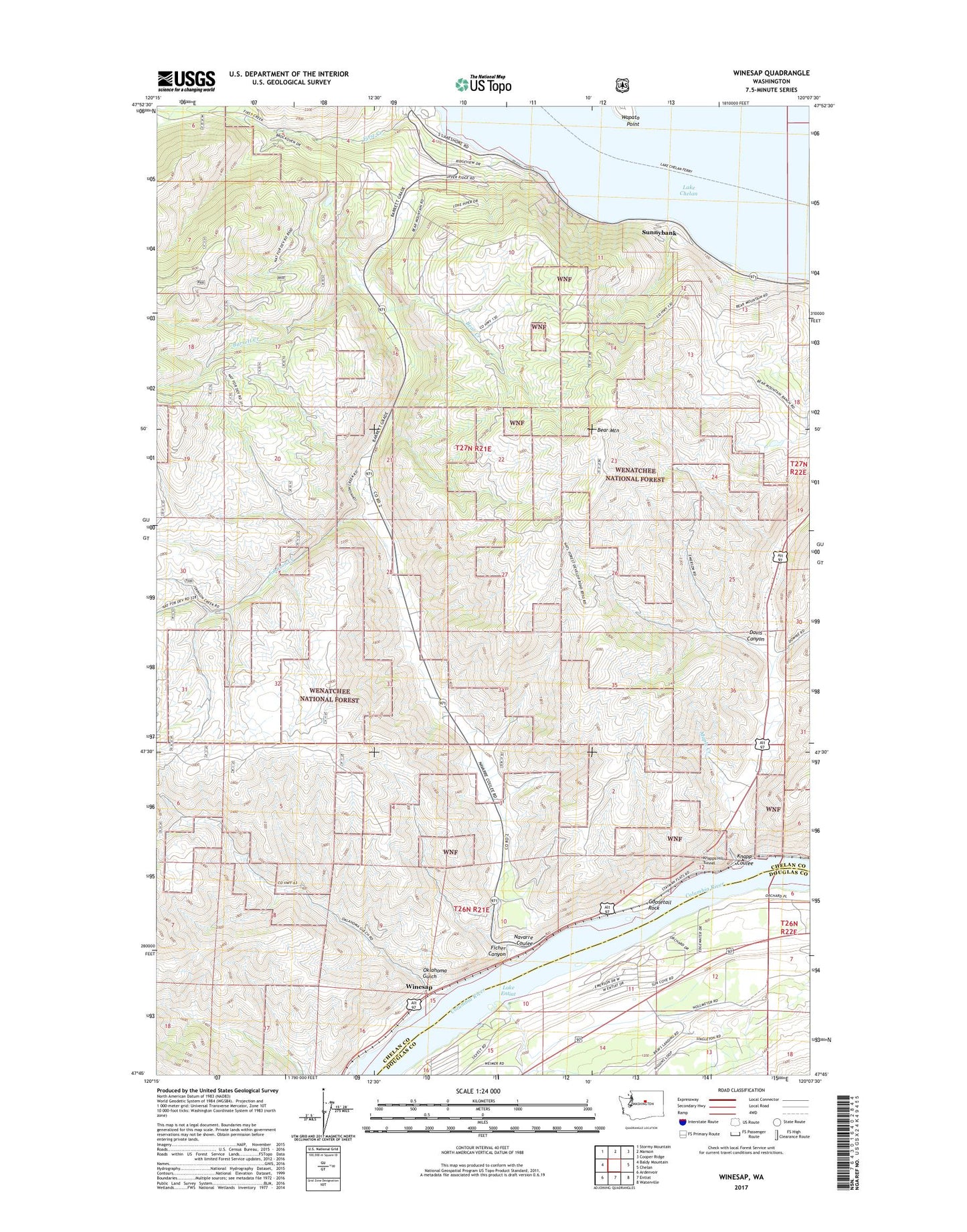
Winesap Washington US Topo Map
Couldn't load pickup availability
Also explore the Winesap Forest Service Topo of this same quad for updated USFS data
2023 topographic map quadrangle Winesap in the state of Washington. Scale: 1:24000. Based on the newly updated USGS 7.5' US Topo map series, this map is in the following counties: Chelan, Douglas. The map contains contour data, water features, and other items you are used to seeing on USGS maps, but also has updated roads and other features. This is the next generation of topographic maps. Printed on high-quality waterproof paper with UV fade-resistant inks.
Quads adjacent to this one:
West: Baldy Mountain
Northwest: Stormy Mountain
North: Manson
Northeast: Cooper Ridge
East: Chelan
Southeast: Waterville
South: Entiat
Southwest: Ardenvoir
This map covers the same area as the classic USGS quad with code o47120g2.
Contains the following named places: Barrett Creek, Bear Creek, Bear Mountain, Davis Canyon, Entiat State Wildlife Area, Ficher Canyon, Goosetail Rock, Johnson Creek, Knapp Coulee, Knapps Hill Tunnel, Lake Chelan State Park, Lake Entiat, Maple Creek, Maplecreek, Navarre Coulee, Oklahoma Gulch, Rocky Pond Airstrip, Ross Private Strip, South Shore, Sunnybank, Wapato Point, Winesap