MyTopo
Winfield Creek Washington US Topo Map
Couldn't load pickup availability
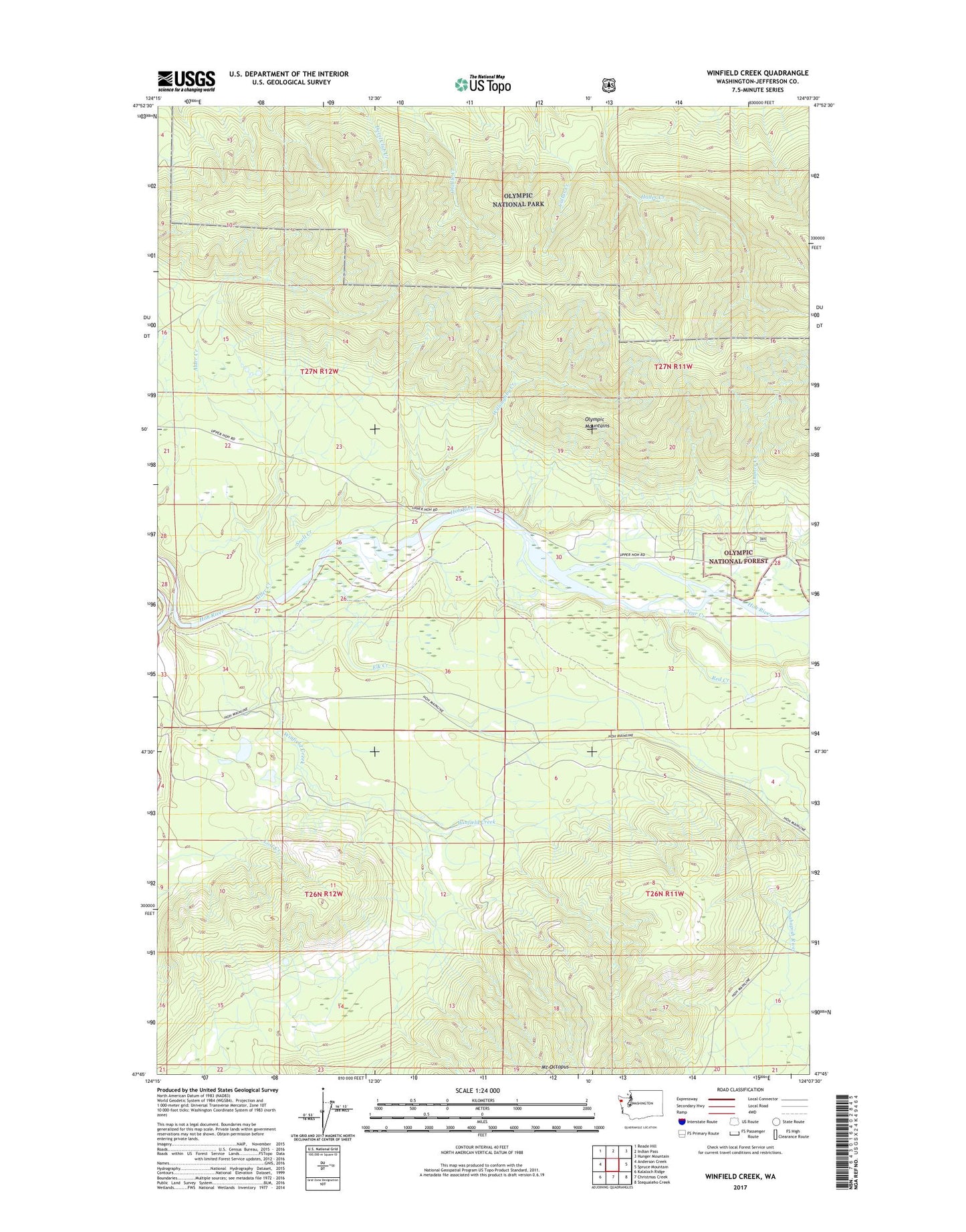
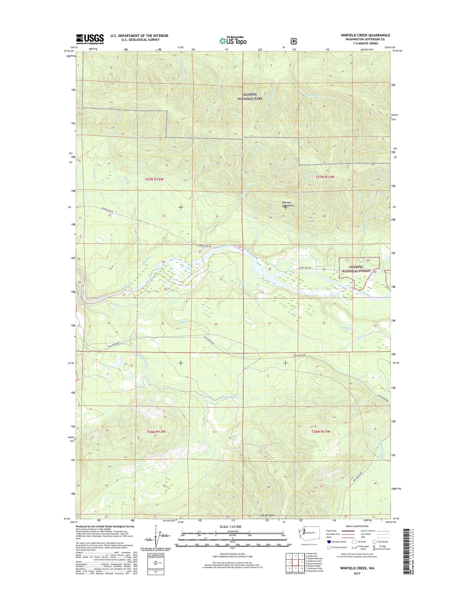
2020 topographic map quadrangle Winfield Creek in the state of Washington. Scale: 1:24000. Based on the newly updated USGS 7.5' US Topo map series, this map is in the following counties: Jefferson. The map contains contour data, water features, and other items you are used to seeing on USGS maps, but also has updated roads and other features. This is the next generation of topographic maps. Printed on high-quality waterproof paper with UV fade-resistant inks.
Quads adjacent to this one:
West: Anderson Creek
Northwest: Reade Hill
North: Indian Pass
Northeast: Hunger Mountain
East: Spruce Mountain
Southeast: Stequaleho Creek
South: Christmas Creek
Southwest: Kalaloch Ridge
Contains the following named places: Alder Creek, Clear Creek, Elk Creek, Fisher Ranch, Lindner Creek, Minnie Peterson Campground, Red Creek, Schmidt Ranch, Snell Creek, Willoughby Creek, Willoughby Creek Campground, Winfield Creek, ZIP Code: 98331