MyTopo
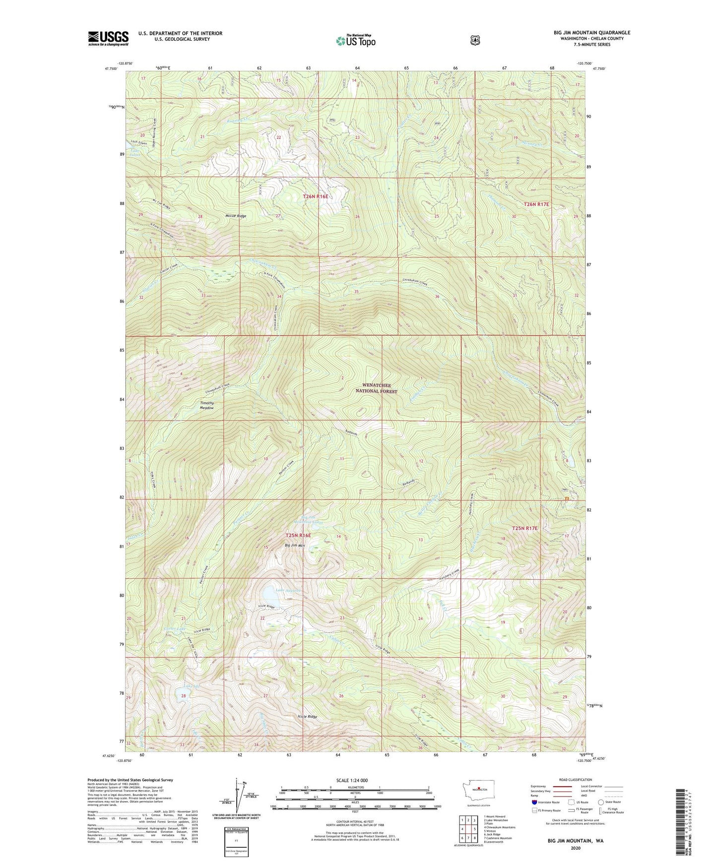
Big Jim Mountain Washington US Topo Map
Couldn't load pickup availability
Also explore the Big Jim Mountain Forest Service Topo of this same quad for updated USFS data
2023 topographic map quadrangle Big Jim Mountain in the state of Washington. Scale: 1:24000. Based on the newly updated USGS 7.5' US Topo map series, this map is in the following counties: Chelan. The map contains contour data, water features, and other items you are used to seeing on USGS maps, but also has updated roads and other features. This is the next generation of topographic maps. Printed on high-quality waterproof paper with UV fade-resistant inks.
Quads adjacent to this one:
West: Chiwaukum Mountains
Northwest: Mount Howard
North: Lake Wenatchee
Northeast: Plain
East: Winton
Southeast: Leavenworth
South: Cashmere Mountain
Southwest: Jack Ridge
This map covers the same area as the classic USGS quad with code o47120f7.
Contains the following named places: Battle Canyon Creek, Big Jim Mountain, Big Jim Mountain Lakes, Carter Lake, Chiwaukum Creek, Foolhen Creek, Glacier Creek, Icicle Ridge, Index Creek, Lake Augusta, Lake Ida, Nalon Creek Game Reserve, Painter Creek, South Fork Chiwaukum Creek, The Badlands, Timothy Meadow, Wenatchee National Forest