MyTopo
Lake Wenatchee Washington US Topo Map
Couldn't load pickup availability
Also explore the Lake Wenatchee Forest Service Topo of this same quad for updated USFS data
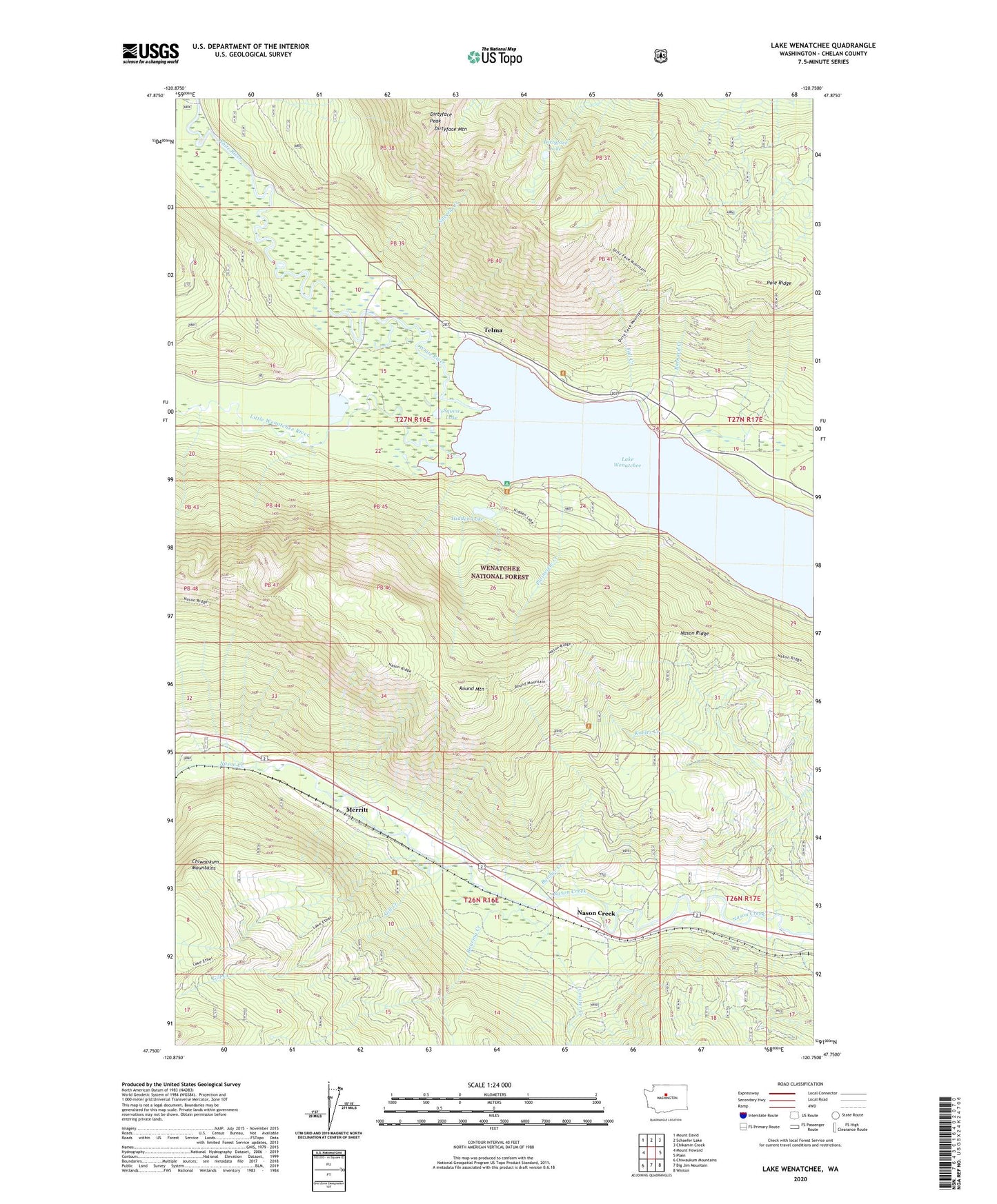
2023 topographic map quadrangle Lake Wenatchee in the state of Washington. Scale: 1:24000. Based on the newly updated USGS 7.5' US Topo map series, this map is in the following counties: Chelan. The map contains contour data, water features, and other items you are used to seeing on USGS maps, but also has updated roads and other features. This is the next generation of topographic maps. Printed on high-quality waterproof paper with UV fade-resistant inks.
Quads adjacent to this one:
West: Mount Howard
Northwest: Mount David
North: Schaefer Lake
Northeast: Chikamin Creek
East: Plain
Southeast: Winton
South: Big Jim Mountain
Southwest: Chiwaukum Mountains
This map covers the same area as the classic USGS quad with code o47120g7.
Contains the following named places: Alpine Lookout, Barnard Creek, Butcher Creek, Camp Zanika Lache, Coulter Creek, Dirtyface Campground, Dirtyface Lake, Dirtyface Lookout, Dirtyface Mountain, Dirtyface Peak, Fall Creek, Gill Creek, Glacier View Campground, Hidden Lake, Kahler Creek, Lake Wenatchee, Lake Wenatchee Campground, Leavenworth Ranger District, Leavenworth-Lake Wenatchee Division, Little Wenatchee River, Merritt, Nason Creek, Nason Creek Rest Area, Nason Creek State Airport, Plainview Creek, Pole Ridge, Roaring Creek, Round Mountain, Silverly Creek, Squaw Lake, Telma, Wenatchee Ridge Viewpoint, Wenatchee River Ranger District-Lake Wenatchee Office, White Pine Campground, White River, White River Viewpoint, ZIP Code: 98826