MyTopo
Wymer Washington US Topo Map
Couldn't load pickup availability
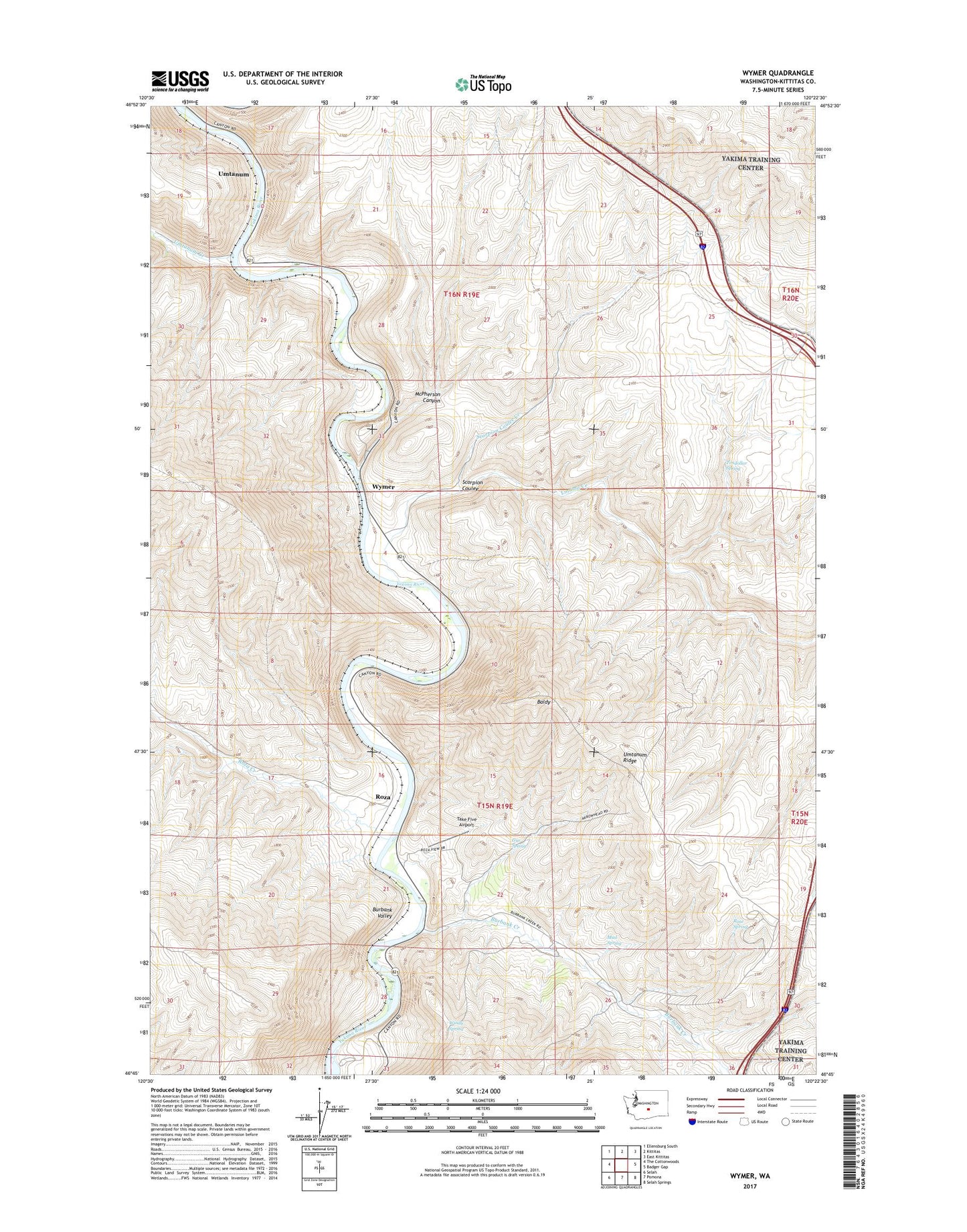
2023 topographic map quadrangle Wymer in the state of Washington. Scale: 1:24000. Based on the newly updated USGS 7.5' US Topo map series, this map is in the following counties: Kittitas. The map contains contour data, water features, and other items you are used to seeing on USGS maps, but also has updated roads and other features. This is the next generation of topographic maps. Printed on high-quality waterproof paper with UV fade-resistant inks.
Quads adjacent to this one:
West: The Cottonwoods
Northwest: Ellensburg South
North: Kittitas
Northeast: East Kittitas
East: Badger Gap
Southeast: Selah Springs
South: Pomona
Southwest: Selah
This map covers the same area as the classic USGS quad with code o46120g4.
Contains the following named places: Baldy, Burbank Creek, Burbank Valley, Gus Spring, Lmuma Creek, McPherson Canyon, Mud Spring, Rose Spring, Roza, Roza Creek, Scorpion Coulee, Scorpion Coulee Creek, Take Five Airport, Tendollar Spring, Umtanum, Umtanum Creek, Windy Spring, Wymer