MyTopo
West Milford West Virginia US Topo Map
Couldn't load pickup availability
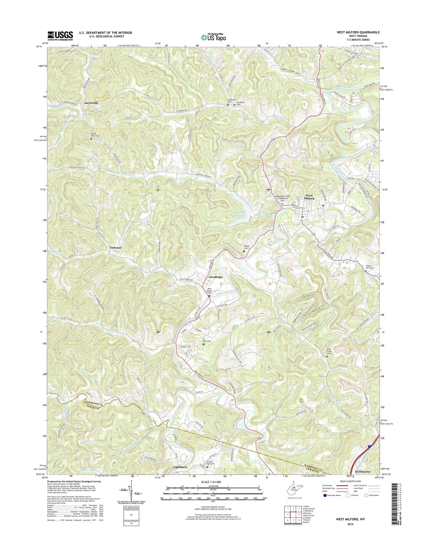
2023 topographic map quadrangle West Milford in the state of West Virginia. Scale: 1:24000. Based on the newly updated USGS 7.5' US Topo map series, this map is in the following counties: Harrison, Lewis. The map contains contour data, water features, and other items you are used to seeing on USGS maps, but also has updated roads and other features. This is the next generation of topographic maps. Printed on high-quality waterproof paper with UV fade-resistant inks.
Quads adjacent to this one:
West: Big Isaac
Northwest: Salem
North: Wolf Summit
Northeast: Clarksburg
East: Mount Clare
Southeast: Berlin
South: Weston
Southwest: Camden
This map covers the same area as the classic USGS quad with code o39080b4.
Contains the following named places: Allen Ford, Ayres School, Bethel Cemetery, Broad Run, Broad Run Cemetery, Broad Run Church, Browns Run, Buffalo Creek, Buffalo Creek Reservoir, Buffalo School, Clarksburg Water Works System Dam, Coburn Fork, Coburn School, Coburns Creek, Cottrill School, Duck Creek, Duck Creek Cemetery, Duck Creek Church, Duck Creek School, Good Hope Census Designated Place, Goodhope, Grant Valley Trailer Court, Hackers Creek, Hall School, Hide A Way Golf Course, Highland Dam, Hollick Run, Isaacs Creek, Isaacs Creek Baptist Church, Jarvisville, Kincheloe Creek, Koblegard School, Lightburn, Lost Creek, McWhorter, McWhorter United Methodist Church, Milford Road, Mount Olive Cemetery, Mount Olive Church, Mutton Town School, New Bethel Cemetery, New Bethel United Methodist Church, Pleasant Hill Church, Post Cemetery, Post School, Pressley Ridge School, Road School, Rose Hill Cemetery and Mausoleum, Sheets Mill Cemetery, Sheets Mill School, Sheets Mills, South Harrison High School, South Harrison Middle School, Southwest District, Sycamore Cemetery, Sycamore Creek, Sycamore Dale School, Sycamore Methodist Church, Tichenal, Town of West Milford, Turkeypen Creek, Two Lick Creek, Two Lick School, Vens Run, Watters Smith Memorial State Park, West Milford, West Milford Community Volunteer Fire Department, West Milford Elementary School, West Milford Police Department, West Milford Post Office, WPDX-AM (Clarksburg), WPDX-FM (Clarksburg), ZIP Code: 26451