MyTopo
Brownton West Virginia US Topo Map
Couldn't load pickup availability
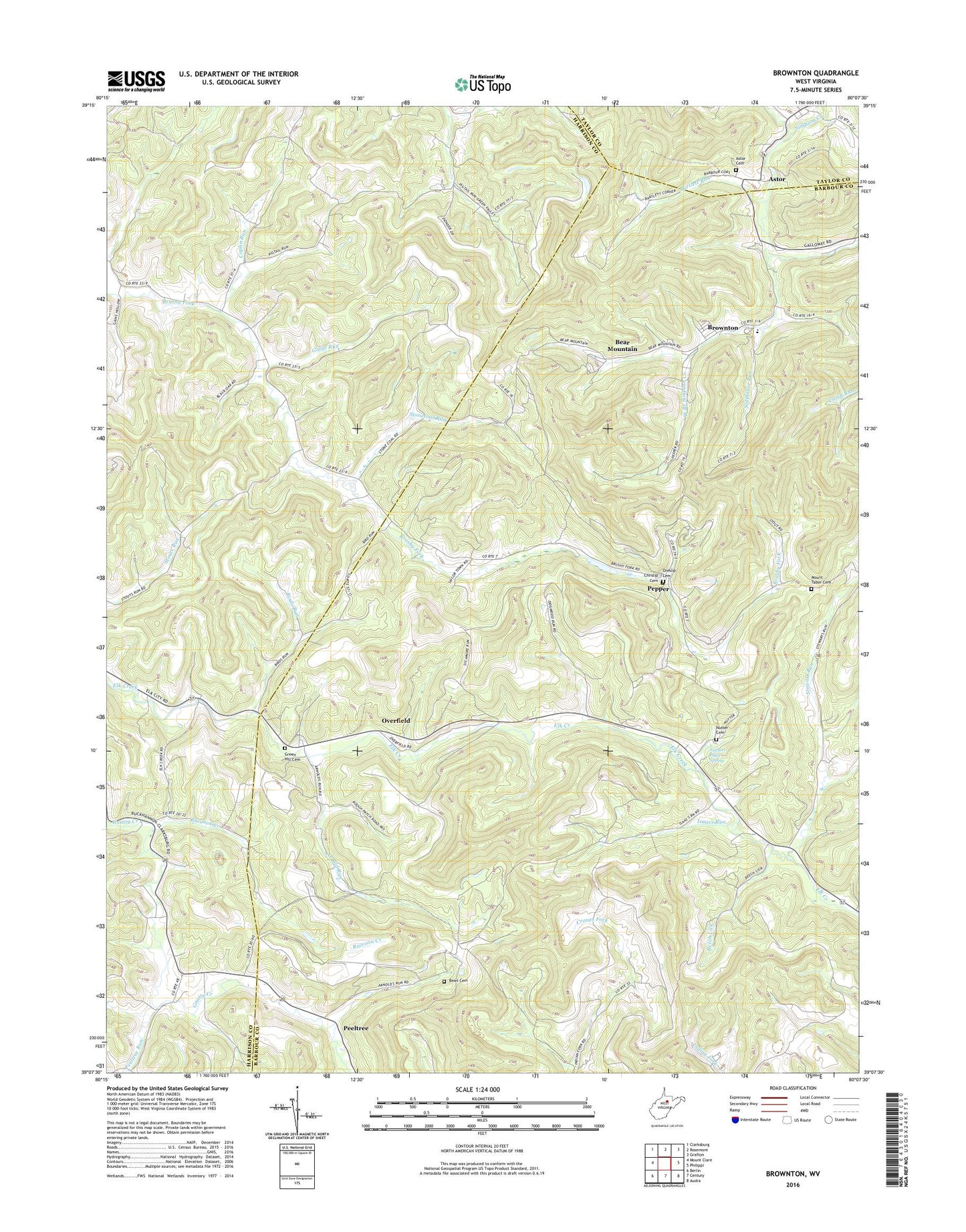
2023 topographic map quadrangle Brownton in the state of West Virginia. Scale: 1:24000. Based on the newly updated USGS 7.5' US Topo map series, this map is in the following counties: Barbour, Harrison, Taylor. The map contains contour data, water features, and other items you are used to seeing on USGS maps, but also has updated roads and other features. This is the next generation of topographic maps. Printed on high-quality waterproof paper with UV fade-resistant inks.
Quads adjacent to this one:
West: Mount Clare
Northwest: Clarksburg
North: Rosemont
Northeast: Grafton
East: Philippi
Southeast: Audra
South: Century
Southwest: Berlin
This map covers the same area as the classic USGS quad with code o39080b2.
Contains the following named places: Arnold Run, Astor, Astor Cemetery, Astor United Methodist Church, Bamgardner School, Bartlett Run, Bean Cemetery, Bear Mountain, Beech Lick, Birds Run, Birds Run School, Brownton, Brownton Census Designated Place, Brushy Fork School, Chrislip Cemetery, Coplin Run, Ebenezer Church, Ebenezer School, Galloway Census Designated Place, Glade Run, Goodwin School, Green Hill Cemetery, Green Hill United Methodist Church, Isaacs Run, Lower Brushy Fork School, Mount Tabor Cemetery, Mount Tabor Church, Mount Vernon Baptist Church, Mount Vernon Elementary School, Mudlick School, Nutter Cemetery, Nutters Place Spring, Oreslip Cemetery, Overfield, Overfield Community Church, Overfield School, Peeltree, Peeltree Run, Peeltree Run School, Pepper, Pigtail Run, Pigtail School, Raccoon Creek, Raccoon School, Rexroad Airport, Stewart Run, Stewart Run School, Stillhouse Run, Stonecoal Run, Trinity Church, West Branch Simpson Creek, ZIP Code: 26349