MyTopo
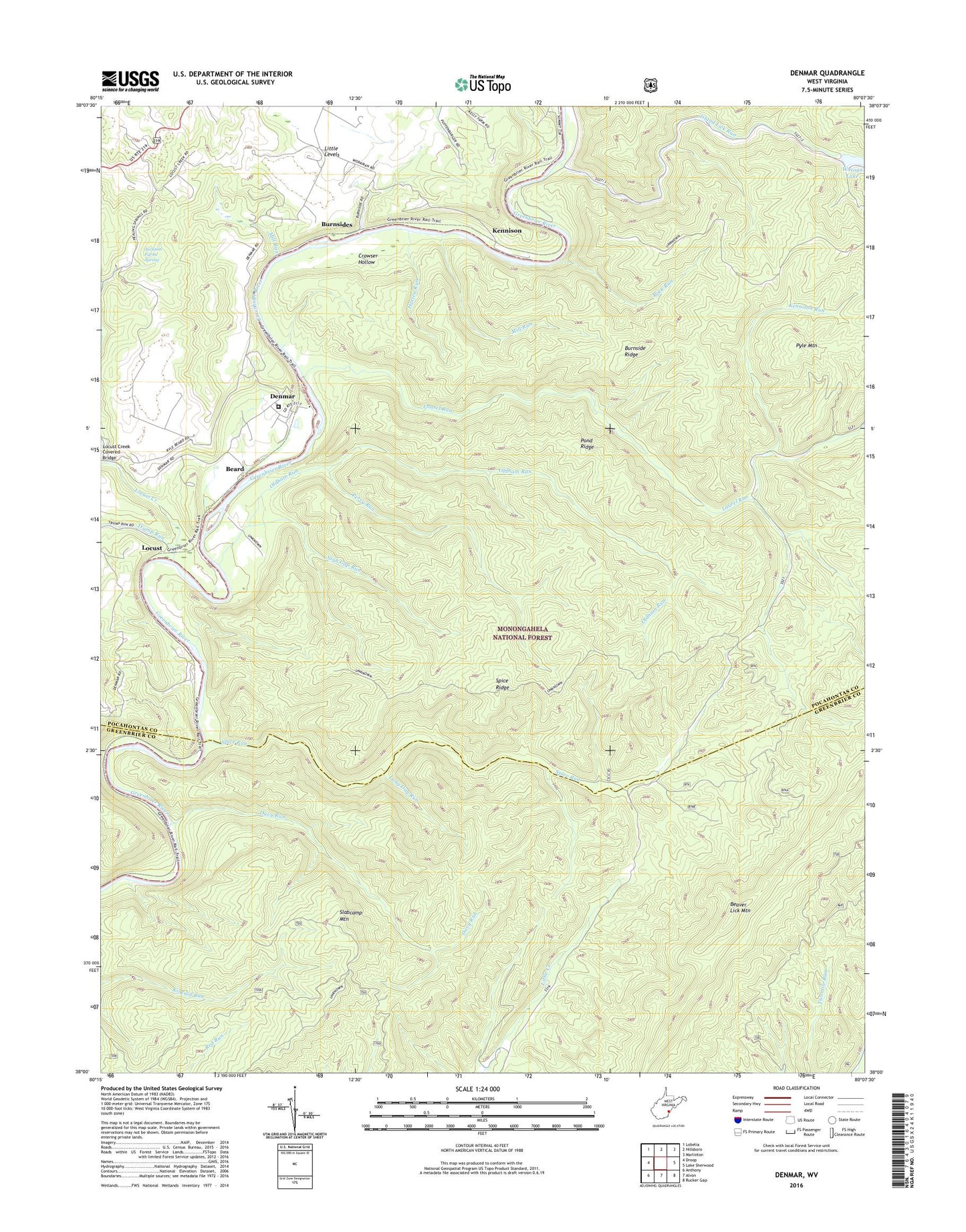
Denmar West Virginia US Topo Map
Couldn't load pickup availability
Also explore the Denmar Forest Service Topo of this same quad for updated USFS data
2023 topographic map quadrangle Denmar in the state of West Virginia. Scale: 1:24000. Based on the newly updated USGS 7.5' US Topo map series, this map is in the following counties: Pocahontas, Greenbrier. The map contains contour data, water features, and other items you are used to seeing on USGS maps, but also has updated roads and other features. This is the next generation of topographic maps. Printed on high-quality waterproof paper with UV fade-resistant inks.
Quads adjacent to this one:
West: Droop
Northwest: Lobelia
North: Hillsboro
Northeast: Marlinton
East: Lake Sherwood
Southeast: Rucker Gap
South: Alvon
Southwest: Anthony
This map covers the same area as the classic USGS quad with code o38080a2.
Contains the following named places: Arrowhead Trail, Bear Pen Run Trail, Beard, Buck and Doe Trail, Burnside Ridge, Burnsides, Calvin Price State Forest, Crowser Hollow, Davy Run, Denmar, Denmar Correctional Center, Denmar School, Denmar State Hospital, Hatten Run, Island Lick Run, Jackson Farm Spring, Kennison, Kennison Run, Laurel Run, Locust, Locust Creek, Locust Creek School, Long Day Run, Maple Grove School, Mill Run, Nigh Gap Run, Old Droop Church, Oldham Run, Perry Run, Pond Ridge, Pyle Mountain, Rock Run, Slabcamp Mountain, Spice Ridge, Spice Ridge Trail, Spice Run, Spice Run Wilderness, Trump Run, Watoga Lake, Watoga State Park