MyTopo
Rig West Virginia US Topo Map
Couldn't load pickup availability
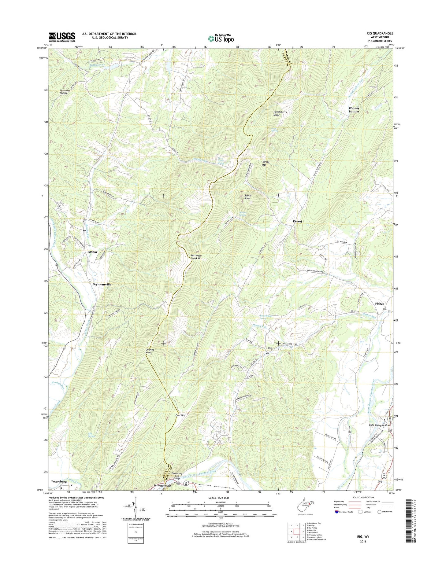
2023 topographic map quadrangle Rig in the state of West Virginia. Scale: 1:24000. Based on the newly updated USGS 7.5' US Topo map series, this map is in the following counties: Hardy, Grant. The map contains contour data, water features, and other items you are used to seeing on USGS maps, but also has updated roads and other features. This is the next generation of topographic maps. Printed on high-quality waterproof paper with UV fade-resistant inks.
Quads adjacent to this one:
West: Maysville
Northwest: Greenland Gap
North: Medley
Northeast: Old Fields
East: Moorefield
Southeast: Lost River State Park
South: Petersburg East
Southwest: Petersburg West
This map covers the same area as the classic USGS quad with code o39079a1.
Contains the following named places: Appalachian Highlands, Arthur, Arthur Post Office, Badleys Ford, Bensenhaver Spring, Brushy Run, Brushy Run School, Burnt House Spring, Charles Knob, Cold Spring Hollow, Cove Spring, Ebb Spring, Fisher, Fisher Post Office, Frosty Hollow School, Frye School, Huckleberry Ridge, Kessel, Mount Carmel Church, Mount Olive Church, Norman Run, North Fork Lunice Creek, Oak Grove Church, Oakdale School, Old Arthur, Orr Mountain School, Orrs Mountain, Parks School, Patterson Creek Structure One Dam, Petersburg Elementary School, Petersburg Gap, Petersburg Gap Bridge, Rig, Rig Post Office, Riverside School, Round Knob, Saint Marys Church, Seymourville, South Branch Career and Technical Center, South Fork Lunice Creek, Teter Creek Lake Dam, Turkey Mountain, Valley View Golf Course, Walnut Bottom, Walnut Bottom School, Warner Spring, WELD-AM (Fisher), Welton, ZIP Code: 26818