MyTopo
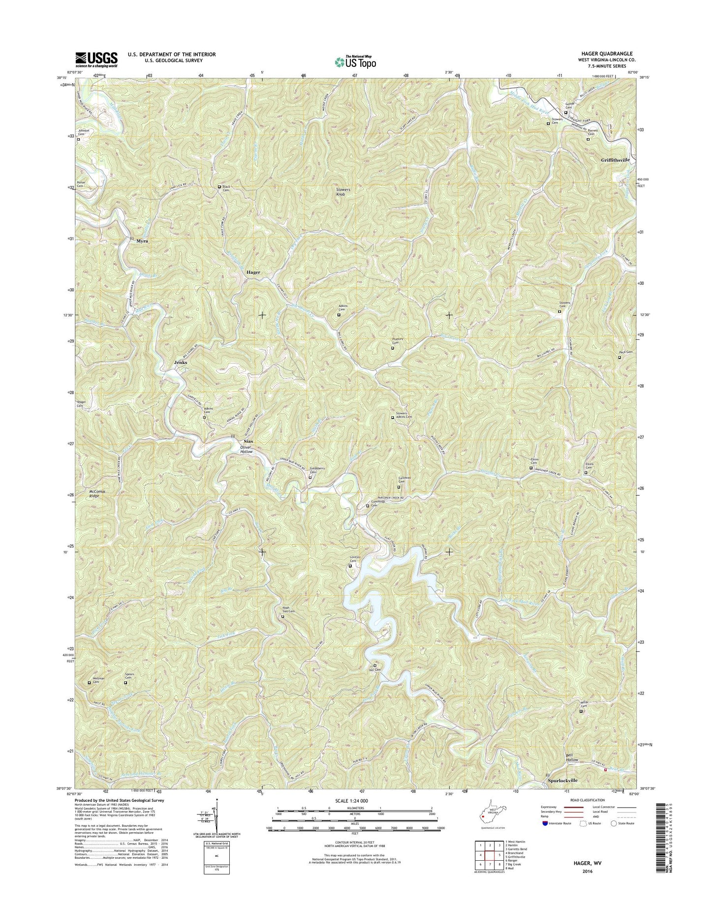
Hager West Virginia US Topo Map
Couldn't load pickup availability
2019 topographic map quadrangle Hager in the state of West Virginia. Scale: 1:24000. Based on the newly updated USGS 7.5' US Topo map series, this map is in the following counties: Lincoln. The map contains contour data, water features, and other items you are used to seeing on USGS maps, but also has updated roads and other features. This is the next generation of topographic maps. Printed on high-quality waterproof paper with UV fade-resistant inks.
Quads adjacent to this one:
West: Branchland
Northwest: West Hamlin
North: Hamlin
Northeast: Garretts Bend
East: Griffithsville
Southeast: Mud
South: Big Creek
Southwest: Ranger
Contains the following named places: Adkins Cemetery, Arm and Hammer Branch, Barrett Cemetery, Bear Branch, Bear Branch Church, Bear Branch School, Bell Hollow, Bernie, Bethel Baptist Church, Big Branch, Big Creek, Big Laurel Church, Big Laurel Creek, Billy Creek, Black Cemetery, Calloway Cemetery, Carpers Branch, Cummings Cemetery, Daniel Branch, Dog Pool Branch, Dry Fork, Elkins Branch, Elkins Cemetery, Fez Creek, Fez School, First Fork, Goldsberry Cemetery, Goode Cemetery, Hager, Hager School, Hanging Rock Branch, Hense Branch, Hill Cemetery, Jefferson District, Jenks, Johnson Cemetery, Josh Branch, Laurel Fork, Laurel Fork School, Left Fork Mud River, Lick Fork, Lick Log Branch, Lincoln County, Lovejoy Cemetery, Merritt Creek, Miller Cemetery, Mount Zion Church, Mud River Volunteer Fire Department, Myra, Myra Methodist Church, Myra Post Office, New Bethel Church, Noah Sias Cemetery, Oliver Hollow, Palermo, Palermo Methodist Church, Panther Branch, Parsner Creek, Peck Cemetery, Pigeon Branch, Plumley Cemetery, Richs Branch, Roadfork Branch, Ruffie Branch, Sandlick Branch, Scary Church, Scary School, Second Fork, Second Fork School, Senging Branch, Sias, Sias Post Office, Slash Branch, Sleepy He Branch, Spears Cemetery, Spurlockville, Spurlockville Post Office, Spurlockville School, Stinson Branch, Stowers - Adkins Cemetery, Stowers Cemetery, Stowers Knob, Straight Fork, Sugartree Fork, Sulphur Springs Fork, Sycamore Fork, Union Church, Union District, Upper Laurel School, Upper Mud River Wildlife Management Area, Upton Branch, Wellman Cemetery, Whitten Church, Whitten School, Wolf Branch